The U.S. Boating Pilots are reproductions of the official NOAA Coast Pilot with masses of other useful information added in an interactive app.
The United States Coast Pilot is published by the National Oceanic and Atmospheric Administration (NOAA). The Coast Pilot supplements the navigational information shown on the chart.
On your tablet or phone click "ADD TO THE HOME SCREEN" and these pages become an app on your device. In apple device first ensure that it is open in safari...It is an html document so can be saved as a web page on your PC.
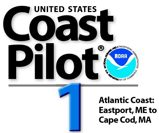
U.S. PILOT 1
Coast Pilot 1 - 45th Edition, 2016 covers the coasts of Maine, New Hampshire, and part of Massachusetts, from Eastport, ME to Provincetown, MA
CHAPTER 1 GENERAL INFORMATION
This is a huge resource on the app with hundreds of useful links to Government, USCG, Wikipedia etc.
CH 2. NAVIGATION REGULATIONS.
This chapter contains extracts from Code of Federal Regulations (CFR) that are of importance to mariners in the area covered by this Coast Pilot.
CH 3. EASTPORT TO CAPE COD
The coasts of Maine, New Hampshire, and part of Massachusetts lie between West Quoddy Head in Maine and Provincetown in Massachusetts. Most of the Maine coast is irregular, rocky, and bold with numerous islands, bays, rivers, and coves. There are numerous fishing villages and towns along the Maine coast which are frequented by tourists during the summer months. The primary deep-draft ports in Maine are at Eastport, Searsport and Portland. The more densely populated coasts of New Hampshire and Massachusetts have numerous sandy beaches and fewer of the islands, bays, and coves which characterize the Maine coast. Major ports are at Portsmouth, NH and Boston, MA.
CH 4. QUADDY NARROWS TO CALAIS, MAINE
This chapter describes the Maine and New Brunswick coasts from Quoddy Narrows through Lubec Channel, Friar Roads, Western Passage, and the St. Croix River to the head of navigation at Calais.
CH 5. QUADDY NARROWS TO PETIT MANAM ISLAND, MAINE
This chapter describes the rugged Maine coast, with its numerous bays, coves, islands, and rivers, from Quoddy Narrows westward to Petit Manan Island. Cutler, Bucks Harbor, Machiasport, Machias, Jonesport, Milbridge.
CH 6. PETIT MANAM ISLAND TO JERICHO BAY, MAINE
The coast between Petit Manan Point and Jericho Bay is indented by Frenchman Bay, Blue Hill Bay, and numerous smaller bays and harbors. Mount Desert Island between Frenchman and Blue Hill Bays, is mountainous and is the highest land feature on the coast of Maine.
CH 7. JERICHO BAY TO PENOBSCOT BAY, MAINE
This chapter describes the Maine coast from Jericho Bay to but not including Muscongus Bay, and the waters and tributaries of East and West Penobscot Bays, Penobscot River, and the many passages and thorofares leading into and connecting these waterways.
CH 8. MUSCONGUS BAY TO CAPE ELIZABETH, MAINE
This chapter describes Muscongus, Booth, Sheepscot, and Casco Bays; Medomak, Damariscotta, Sheepscot, Kennebec, and New Meadows Rivers; and the ports of Portland, Bath, Boothbay Harbor, and Wiscasset. This area has many islands, rocks, and long peninsulas.
CH 9. CAPE ELIZABETH TO CAPE ANN, MASSACHUSETTS
From Cape Elizabeth the coast of Maine continues southwestward for about 37 miles to the Piscataqua River and the deepwater port of Portsmouth, NH. The few harbors along this part of Maine are suited mostly to fishing vessels, yachts, and small pleasure craft.
CH 10. CAPE ANN TO BOSTON HARBOR, MASSACHUSETTS
This chapter describes the Massachusetts coast along the northwestern shore of Massachusetts Bay from Cape Ann southwestward to but not including Boston Harbor.
CH 11. BOSTON HARBOR AND APPROACHES
This chapter describes Boston Harbor, its approaches and tributaries, and the major commercial facilities in the port of Boston.
CH 12. MINOTS LEDGE TO PROVINCETOWN, MASSACHUSETTS.
This chapter describes the Massachusetts coast southward from Minots Ledge, off Cohasset Harbor, to and including Cape Cod Bay
APPENDIX A SALES INFORMATION
APPENDIX B METEOROLOGICAL DATA
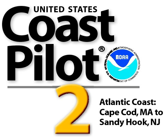
U.S. PILOT 2
Coast Pilot 2 covers the Atlantic coast from Cape Cod to Sandy Hook, embracing part of the Massachusetts coast and all of the coasts of Rhode Island, Connecticut, and New York.
The app links to charts, aerial photos, marinas, port authorities, wind charts, anchorages, tides, weather, local knowledge, tips, boatbuzz forum, itineraries, nav rules, ocean currents, safety information, traffic services, radio frequencies, videos, docks, fuel, supplies, lighthouses, repairs, marine parks, general knowledge, sightseeing, environmental issues, warnings, Federal Regulations, Wikipedia, Facebook forum, U.S.C.G. and more. + Your screen can become a full screen weather radar. + See the surrounding ships in real time on your screen with a link to AIS. + View updated charts using online chart viewer. + Before departure download and print current charts in booklet form.
Coast Pilot 2 covers the Atlantic coast from Cape Cod to Sandy Hook, embracing part of the Massachusetts coast and all of the coasts of Rhode Island, Connecticut, and New York.
Topics in the Coast Pilot include channel descriptions, anchorages, bridge and cable clearances, currents, tide and water levels, prominent features, pilotage, towage, weather, ice conditions, wharf descriptions, dangers, routes, traffic separation schemes, small-craft facilities, and Federal regulations applicable to navigation.
Chapter 1. GENERAL INFORMATION.
The app links to hundreds of pieces of useful information.
Chapter 2. NAVIGATION REGULATIONS
The complete online updated Code of Federal Regulations is linked in the app.
Chapter 3. Cape Cod To Sandy Hook
The Atlantic coast from Cape Cod to Sandy Hook embraces part of the coast of Massachusetts and all of the coasts of Rhode Island, Connecticut, and New York. To the mariner this area presents problems of unusual difficulty because of the off-lying shoals, strong and variable currents, large amounts of fog, and turbulence of wind and sea in the great storms that so frequently sweep it.
Chapter 4. Outer Cape Cod and Nantucket Sound
This chapter describes the outer shore of Cape Cod and Nantucket Sound including Nantucket Island and the southern and eastern shores of Martha’s Vineyard. Also described are Nantucket Harbor, Edgartown Harbor, and the other numerous fishing and yachting centers along the southern shore of Cape Cod bordering Nantucket Sound.
Chapter 5. Vineyard Sound and Buzzards Bay
This chapter describes Vineyard Sound and Buzzards Bay following the Massachusetts coast of Vineyard Sound, the northwestern shore of Martha’s Vineyard, the eastern shore of Buzzards Bay, the Cape Cod Canal, and the western shore of Buzzards Bay. Also described are Woods Hole, Cuttyhunk, Onset, Wareham, and the port of New Bedford, as well as the numerous fishing and yachting centers along the sound and bay.
Chapter 6. Narragansett Bay
This chapter describes the Sakonnet River, Narragansett Bay, Mount Hope Bay, and Taunton and Providence Rivers. Also discussed are the ports of Newport, Fall River, and Providence, as well as the numerous other yachting and fishing centers in this area.
Chapter 7. Block Island Sound
This chapter describes Block Island Sound, Fishers Island Sound, Gardiners Bay, Little Peconic Bay, Great Peconic Bay, and the ports and harbors in the area, the more important of which are Point Judith Harbor, Great Salt Pond, Stonington, Mystic Harbor, and Greenport
Chapter 8. Eastern Long Island Sound
This chapter describes the eastern portion of Long Island Sound following the north shore from Thames River
Chapter 9. Western Long Island Sound
This chapter describes the western part of Long Island Sound along the north shore from Bridgeport to Throgs Neck, the south shore from Old Field Point to Willets Point, and the East and Harlem Rivers.
Chapter 10. South Coast of Long Island
This chapter describes the south coast of Long Island from Shinnecock Inlet to and including East Rockaway Inlet; several other inlets making into the beach along this part of the coast; and the canals, bays, and tributaries inside the beach. Also described are the towns of Patchogue and Oceanside, including Oceanside oil terminals; Bay Shore, a large fishing center; and the many smaller communities which support a large small-craft activity
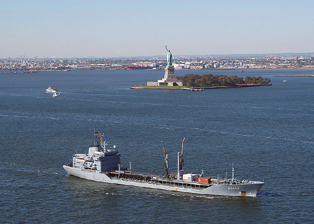
Chapter 11. New York Harbor and Approaches
This chapter describes New York Harbor, its approaches, and the areas adjacent to it, bounded by and including Jamaica Bay to the eastward and Sandy Hook Bay to the southward.
Chapter 12. Hudson River.
This chapter describes the Hudson River from New York City to Troy, NY, and includes the principal cities of Yonkers, Newburgh, Poughkeepsie, Kingston, and Albany.
Appendix A. Sales Information
Appendix B. Meteorological Data
U.S. PILOT 3
Edition 49. 2016. The app is in the print book.
The app links to charts, aerial photos, marinas, port authorities, wind charts, anchorages, tides, weather, local knowledge, tips, boatbuzz forum, itineraries, nav rules, ocean currents, safety information, traffic services, radio frequencies, videos, docks, fuel, supplies, lighthouses, repairs, marine parks, general knowledge, sightseeing, environmental issues, warnings, Federal Regulations, Wikipedia, Facebook forum, U.S.C.G. and more. + Your screen can become a full screen weather radar.
+ See the surrounding ships in real time on your screen with a link to AIS.
+ View updated charts using online chart viewer.
+ Before departure download and print current charts in booklet form.
Coast Pilot 3 covers the Atlantic coast from Sandy Hook to Cape Henry, including the New Jersey Coast, Delaware Bay, Philadelphia, the Delaware - Maryland - Virginia coast, and the Chesapeake Bay.
Topics in the Coast Pilot include channel descriptions, anchorages, bridge and cable clearances, currents, tide and water levels, prominent features, pilotage, towage, weather, ice conditions, wharf descriptions, dangers, routes, traffic separation schemes, small-craft facilities, and Federal regulations applicable to navigation.
CH 1. GENERAL INFORMATION
This is a huge resource on the app with hundreds of useful links to Government, USCG, Wikipedia etc.
CH 2. NAVIGATION REGULATIONS.
This chapter contains extracts from Code of Federal Regulations (CFR) that are of importance to mariners in the area covered by this Coast Pilot.
CH 3. Sandy Hook to Cape Henry
Between New York Bay and Delaware Bay is the New Jersey coast with its many resorts, its inlets, and its Intracoastal Waterway. Delaware Bay is the approach to Wilmington, Chester, Philadelphia, Camden, and Trenton; below Wilmington is the Delaware River entrance to the Chesapeake and Delaware Canal, the deep inside link between Chesapeake and Delaware Bays. The Delaware-Maryland-Virginia coast has relatively few resorts; the numerous inlets are backed by a shallow inside passage that extends all the way from Delaware Bay to Chesapeake Bay. The last seven chapters, nearly half of this book, are required to describe Chesapeake Bay to Norfolk and Newport News, to Washington and Baltimore, and to Susquehanna River 170 miles north of the Virginia Capes.
CH 4. New Jersey Coast
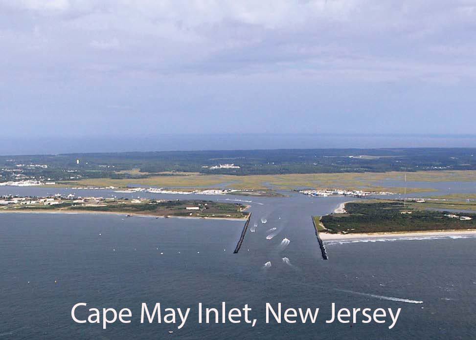
This chapter describes the coast of New Jersey from Sandy Hook to Cape May Point, and the various inlets which make into it from the Atlantic Ocean. Also discussed are the resort towns of Atlantic City, Ocean City, and Cape May.
CH 5. Intracoastal Waterway
The Intracoastal Waterway is a toll-free passage which roughly parallels the Atlantic Coast and extends 118 statute miles through bays, lagoons, thorofares, and land cuts from Manasquan Inlet to Delaware Bay at a point 2 miles north of Cape May Light.
(2) In addition to the Intracoastal Waterway and the waters through which it passes, this chapter also describes the several rivers and tributaries that empty into these waters, as well as some of the more important towns and landings along these waterways.
CH 6. Delaware Bay
This chapter describes Delaware Bay and River, and their navigable tributaries, and includes an explanation of the Traffic Separation Scheme at the entrance to the bay. Major ports covered are Wilmington, Chester, Philadelphia, Camden, and Trenton, with major facilities at Delaware City, Deepwater Point, and Marcus Hook. Also described are Christina River, Salem River, and Schuylkill River, the principal tributaries of Delaware River, and other minor waterways, including Mispillion, Maurice, and Cohansey Rivers.
CH 7. Chesapeake and Delaware Canal
Chart 12277 The Chesapeakeand Delaware Canal is a sea-level waterway that extends from Delaware River at Reedy Point, DE, to Back Creek at Chesapeake City, MD, thence down Back Creek to Elk River and Chesapeake Bay. The Reedy Point entrance is 51 miles above the Delaware Capes, 35.5 miles below Philadelphia, 62 miles from Baltimore, and 187.5 miles from the Virginia Capes. Miles in the following text are the distances in nautical miles along the canal from the middle of Delaware River. Reedy Point at Mile 0.7 on the north side of the Delaware entrance, is jettied and is marked by a light; the jetty on the south side is similarly marked.
CH 8. Delaware-Maryland-Virginia Coast
This chapter describes that section of the Delaware, Maryland, and Virginia coastline extending from Cape Henlopen to Cape Charles and the Virginia Inside Passage. Included in the discussion are Roosevelt Inlet, the Delaware Bay entrance to the Lewes and Rehoboth Canal, Indian River Inlet, Assawoman Canal and Bay, Isle of Wight Bay, Ocean City Inlet, Chincoteague Bay and Inlet, and the various inlets that lead through the barrier beach to the Virginia Inside Passage.
CH 9. Chesapeake Bay Entrance
This chapter describes the deep-draft southerly entrance to Chesapeake Bay from the Atlantic Ocean; the waters of Lynnhaven Roads, Lynnhaven Inlet, Little Creek, Hampton Roads, Willoughby Bay, Lafayette River, and Elizabeth River, including Western, Eastern, and Southern Branches; and the ports of Hampton, Newport News, Norfolk, Berkley, Portsmouth, and Chesapeake.
CH 10. Chesapeake Bay, James River
This chapter describes the James River and several of its tributaries of which the Nansemond, Chickahominy, and Appomattox Rivers are the more important. Also discussed are the ports of Richmond and Hopewell, as well as several of the minor ports and landings on these waterways.
CH 11. Chesapeake Bay, York and Rappahannock Rivers
This chapter describes the western shore of Chesapeake Bay from Old Point Comfort to the Potomac River including its principal tributaries Back, Poquoson, York, Piankatank, Rappahannock, and Great Wicomico Rivers, and Mobjack Bay. Also discussed are the ports of Yorktown, Fredericksburg, West Point, Tappahannock, Kilmarnock, and Reedville, as well as several of the smaller ports and landings on these waterways.
CH 12. Chesapeake Bay, Potomac River
This chapter describes the Potomac River and the numerous tributaries that empty into it; included are Coan, St. Marys, Yeocomico, Wicomico, and Anacostia Rivers. Also described are the ports of Washington, DC, and Alexandria, and several smaller ports and landings on these waterways.
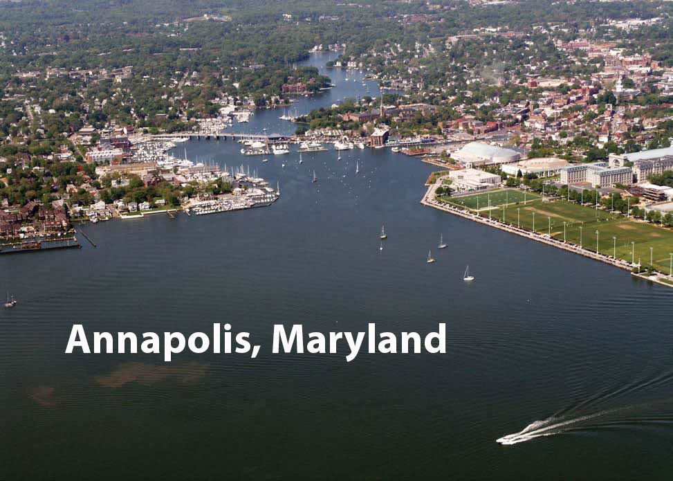
CH 13. Chesapeake Bay, Patuxent and Severn Rivers
This chapter describes the western shore of Chesapeake Bay from Point Lookout, on the north side of the entrance to Potomac River, to Mountain Point, the northern entrance point to Magothy River. Also described are Patuxent River, Herring Bay, West River, South River, Severn River, and Magothy River, the bay’s principal tributaries; the ports of Solomons Island, Benedict, Chesapeake Beach, Shady Side, Galesville, and Annapolis; and several of the smaller ports and landings on these waterways.
CH 14. Chesapeake Bay, Eastern Shore
(1) This chapter describes the Eastern Shore of Chesapeake Bay from Cape Charles to Swan Point, about 6 miles northward of the entrance to Chester River, and several bodies of water and their tributaries that empty into this part of the bay. Included are Pocomoke Sound, Pocomoke River, Tangier Sound, Wicomico River, Nanticoke River, Little Choptank River, Choptank River, Eastern Bay, and Chester River, and the off-lying islands of Tangier, Smith, Hooper, and Tilghman.
(2) Also described are the ports of Cape Charles, Pocomoke City, Tangier, Crisfield, Salisbury, Easton, Cambridge, St. Michaels, and several smaller ports and landings.
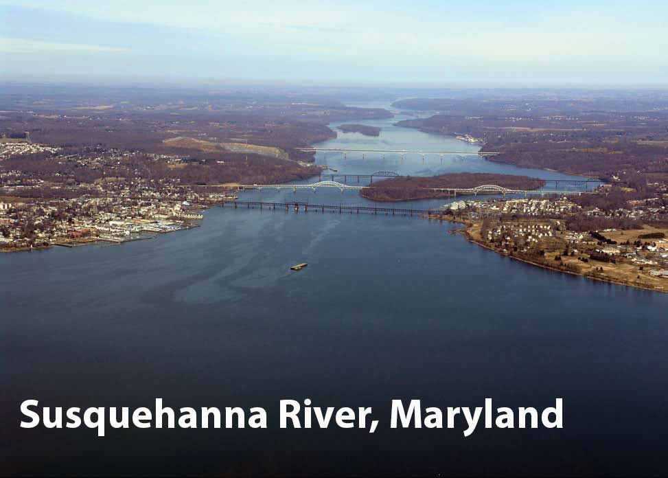
CH 15. Baltimore to Head of Chesapeake Bay
This chapter describes the northern part of Chesapeake Bay and the many tributaries that empty into it, including the more important Patapsco, Elk, and Susquehanna Rivers. Also described is the major port of Baltimore and several smaller ports and landings in this part of the bay.
APPENDIX A
SALES INFORMATION
APPENDIX B
METEOROLOGICAL DATA
U.S. PILOT 4
Coast Pilot 4 covers the Atlantic coast of the United States from Cape Henry to Key West.
Edition 46. 2016. This book now has a link to an interactive app.
The app links to charts, aerial photos, marinas, port authorities, wind charts, anchorages, tides, weather, local knowledge, tips, boatbuzz forum, itineraries, nav rules, ocean currents, safety information, traffic services, radio frequencies, videos, docks, fuel, supplies, lighthouses, repairs, marine parks, general knowledge, sightseeing, environmental issues, warnings, Federal Regulations, Wikipedia, Facebook forum, U.S.C.G. and more.
+ Your screen can become a full screen weather radar.
+ See the surrounding ships in real time on your screen with a link to AIS.
+ View updated charts using online chart viewer.
+ Before departure download and print current charts in booklet form.
Coast Pilot 4 covers the Atlantic coast of the United States from Cape Henry to Key West.
Topics in the Coast Pilot include channel descriptions, anchorages, bridge and cable clearances, currents, tide and water levels, prominent features, pilotage, towage, weather, ice conditions, wharf descriptions, dangers, routes, traffic separation schemes, small-craft facilities, and Federal regulations applicable to navigation.
CH 1. GENERAL INFORMATION
This is a huge resource on the app with hundreds of useful links to Government, USCG, Wikipedia etc.
CH 2. NAVIGATION REGULATIONS.
This chapter contains extracts from Code of Federal Regulations (CFR) that are of importance to mariners in the area covered by this Coast Pilot.
CH 3. Cape Henry to Key West
The Atlantic Coast of the United States from Cape Henry to Cape Florida is low and sandy, backed by woods. From Cape Florida to Key West the coast is formed by a long chain of small islands known as the Florida Keys. The Florida Reefs extend seaward of the keys and are nearly parallel to them.
CH 4. Cape Henry to Cape Lookout
This chapter describes a 190-mile section of the Virginia and North Carolina coastline between Cape Henry and Cape Lookout, known as The Outer Banks, and the series of sounds and tributary waters behind the banks through which the Intracoastal Waterway passes from Chesapeake Bay southward. The Outer Banks, a line of long, low, and narrow islands, include the Portsmouth Islands, the uninhabited Core Banks, and Bodie, Hatteras, and Ocracoke Islands, parts of which comprise the Cape Hatteras National Seashore.
CH 5. Cape Lookout to Cape Fear
This chapter describes the deepwater ports of Morehead City and Wilmington, and the smaller ports of Beaufort, Swansboro, Jacksonville, Wrightsville Beach, Wrightsville, Carolina Beach, and Southport. These smaller ports are principally engaged in barge, fishing, and small-craft traffic.
Also discussed are the waters of Cape Fear River and its tributaries; Bogue, Stump, and Topsail Sounds; and Beaufort, Bogue, and New River Inlets, including some of the lesser inlets.
CH 6. Cape Fear to Charleston Harbor
This chapter describes the coast of North and South Carolina from Cape Fear to Charleston Harbor.
Also discussed are the deepwater ports of Charleston and Georgetown, SC; several smaller ports of which Wando and Mount Pleasant are the more important; Winyah Bay and its tributary rivers; the waters of Ashley, Wando, and Cooper Rivers and their tributaries; several of the minor rivers; and the shallow inlets which make into this section of the coast, including Shallotte, Little River, Dewees, North, Price, and Capers.
CH 7. Charleston Harbor to Savannah River
This chapter describes the coastline from Charleston Harbor to Savannah River. The coast, low and timbered, trends in a southwesterly direction for 65 miles and is broken by St. Helena, Port Royal, and Calibogue Sounds, and by numerous inlets from which there is access to the interior by way of the rivers emptying into them. Shoal water extends 3 to 8 miles offshore.
CH 8. Savannah River to St. Johns River
This chapter describes the coasts of South Carolina, Georgia, and Florida from Savannah River to St. Johns River, and includes the deepwater ports of Brunswick, GA, and Fernandina Beach, Fla. Also discussed are Wassaw, Ossabaw, St. Catherines, Sapelo, Doboy, Altamaha, St. Simons, St. Andrew, Jekyll, Cumberland, and Nassau Sounds, and their tributaries, and several of the small towns along these waterways.
CH 9. St. Johns River
St. Johns River the largest in eastern Florida, is about 248 miles long and is an unusual major river in that it flows from south to north over most of its length. It rises in the St. Johns Marshes near the Atlantic coast below latitude 28°00'N., flows in a northerly direction, and empties into the sea north of St. Johns River Light in latitude 30°24'N. The river is the approach to the city of Jacksonville and a number of towns near its shores. Some of these places are winter resorts while others are centers of farming districts and citrus groves. Deep-draft vessels go as far as just below the Main Street Bridge. Southward of the Jacksonville bridges, commercial traffic is light and consists almost entirely of oil barges. Many pleasure craft navigate this part of the river, usually going only as far as Sanford, though small boats have navigated the river as far as Lake Washington, 188 miles south of Jacksonville.
CH 10. St. Johns River to Miami
This chapter describes the Florida coast southward from the St. Johns River (30°24'N., 81°24'W.) to Miami (25°46'N., 80°08'W.), and includes the deepwater ports at Port Canaveral, Fort Pierce, Port of Palm Beach, Port Everglades, and Miami. Information for offshore navigation is given first, followed by a detailed description of the coast, inlets, and seaports.
CH 11. Miami to Key West
This chapter describes the Florida Keys and the various passages that lead through it from the Straits of Florida and Hawk Channel to Florida Bay and the Gulf of Mexico. Also discussed are Key West Harbor and the small-craft basins at Key West, Boot Key Harbor, Safe Harbor, and several other small-craft harbors along the Florida Keys.
CH 12. Intracoastal Waterway
The part of the Intracoastal Waterway described here is the toll-free “canal” which affords continuous protected passage behind the Atlantic Coast and the Florida Keys for more than 1,243 statute miles between Norfolk, VA, and Key West, FL Route 1 the basic route, follows Albemarle and Chesapeake Canal to Albemarle Sound; Route 2 the alternate route, is through Great Dismal Swamp Canal to the sound.
APPENDIX A
SALES INFORMATION
APPENDIX B
METEOROLOGICAL DATA
U.S. PILOT 5
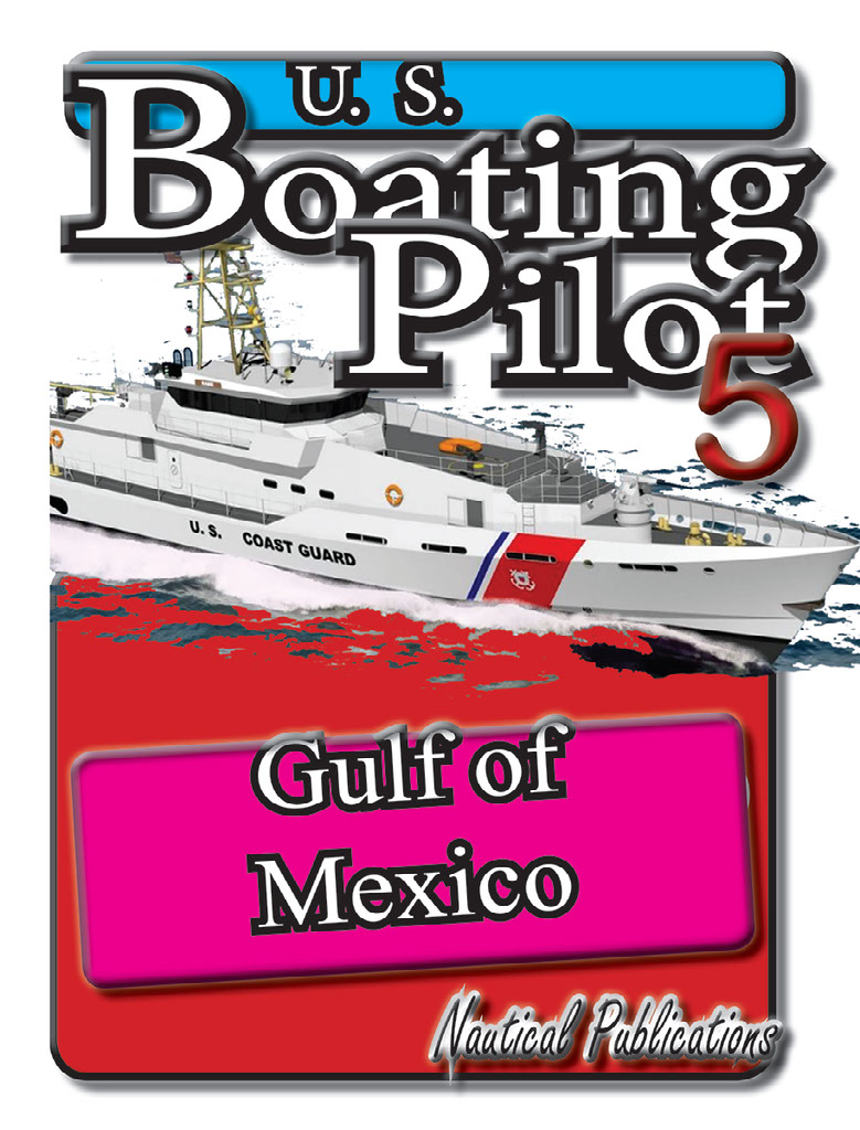
Coast Pilot 5 covers the Gulf of Mexico from Key West, FL to the Rio Grande. This area is generally low and mostly sandy, presenting no marked natural features to the mariner approaching from seaward. so covers Puerto Rico and the Virgin Islands.
Edition 43. 2016.
This book now has a link to an interactive app.
The app links to charts, aerial photos, marinas, port authorities, wind charts, anchorages, tides, weather, local knowledge, tips, boatbuzz forum, itineraries, nav rules, ocean currents, safety information, traffic services, radio frequencies, videos, docks, fuel, supplies, lighthouses, repairs, marine parks, general knowledge, sightseeing, environmental issues, warnings, Federal Regulations, Wikipedia, Facebook forum, U.S.C.G. and more.
+ Your screen can become a full screen weather radar.
+ See the surrounding ships in real time on your screen with a link to AIS.
+ View updated charts using online chart viewer.
+ Before departure download and print current charts in booklet form.
Coast Pilot 5 covers the Gulf of Mexico from Key West, FL to the Rio Grande. This area is generally low and mostly sandy, presenting no marked natural features to the mariner approaching from seaward. so covers Puerto Rico and the Virgin Islands.
Topics in the Coast Pilot include channel descriptions, anchorages, bridge and cable clearances, currents, tide and water levels, prominent features, pilotage, towage, weather, ice conditions, wharf descriptions, dangers, routes, traffic separation schemes, small-craft facilities, and Federal regulations applicable to navigation.
CH 1. GENERAL INFORMATION
This is a huge resource on the app with hundreds of useful links to Government, USCG, Wikipedia etc.
CH 2. NAVIGATION REGULATIONS.
This chapter contains extracts from Code of Federal Regulations (CFR) that are of importance to mariners in the area covered by this Coast Pilot.
CH 3. Gulf of Mexico
The Gulf of Mexico coast of the United States, from Key West, FL, to the Rio Grande, is low and mostly sandy, presenting no marked natural features to the mariner approaching from seaward; shoal water generally extends well offshore. The principal points and harbor entrances are marked by lights, which are the chief guides for approaching or standing along the coast.
CH 4. Key West to Tampa Bay
This chapter describes the W coast of Florida from Key West to Tampa Bay, and the ports of Key West, Naples, Fort Myers, Port Boca Grande, Venice, and Sarasota, and many of the smaller ports and landings. Also described are the Ten Thousand Islands, Big Marco Pass, Gordon Pass, Estero Island, Matanzas Pass, San Carlos Bay, Caloosahatchee River, Sanibel Island, Charlotte Harbor, Peace River, Myakka River, Gasparilla Sound, Gasparilla Island, New Pass, Venice Inlet, Big Sarasota Pass, Lido Key, Longboat Key, Longboat Pass, and Anna Maria Key.
CH 5. Tampa Bay to Apalachee Bay
This chapter describes the 170-mile Gulf coast of Florida from Tampa Bay to Apalachee Bay, the numerous rivers emptying into this section of the Gulf, and the passes making from the Gulf to the Intracoastal Waterway. Also described are the deepwater ports of Tampa, Port Tampa, Port Sutton, St. Petersburg, and Port Manatee, and many smaller ports.
CH 6. Apalachee Bay to Mobile Bay
This chapter describes the coasts of Florida and Alabama bordering the Gulf of Mexico from Apalachee Bay to Mobile Bay and the numerous bodies of water emptying into the Gulf including Apalachee Bay, St. George Sound, Apalachicola Bay, St. Joseph Bay, St. Andrew Bay, Pensacola Bay, and their tributaries. Also discussed are the ports of Port St. Joe, Panama City, and Pensacola, and other smaller ports and landings.
CH 7. Mobile Bay to Mississippi River
This chapter describes the coasts of Alabama, Mississippi, and Louisiana bordering the Gulf of Mexico from Mobile Bay to the Mississippi River and the numerous bodies of water emptying into the Gulf, including Breton Bay, Mobile Bay, Mississippi Sound, Lake Borgne, Lake Pontchartrain, Chandeleur Sound, Breton Sound, and their tributaries. Also discussed are Mobile, Pascagoula, Biloxi, and Gulfport, and other smaller ports and landings.
CH 8. Mississippi River
This chapter describes the Mississippi River from the delta passes at the Gulf of Mexico to Baton Rouge, 217 miles via Southwest Pass, 211 miles via South Pass, above the Gulf. Also described are the deepwater ports of New Orleans and Baton Rouge, as well as the facilities at the many small communities along the river.
CH 9. Mississippi River to Sabine Pass
This chapter describes the coast of Louisiana from the delta of the Mississippi River to Sabine Pass, TX Also discussed are Barataria, Timbale, Terrebonne, Atchafalaya, East and West Cote Blanche, and Vermilion Bays, and the interconnecting rivers and bayous which form a network of waterways in this section of Louisiana. The deepwater port of Lake Charles as well as many smaller ports and cities are described.
CH 10. Sabine Pass to San Luis Pass
This chapter describes the 77-mile-long Texas Gulf Coast from Sabine Pass to San Luis Pass, and Port Arthur Canal, Sabine-Neches Canal, Neches River, Galveston Bay, East and West Bays, Houston Ship Channel and their tributary waterways. Also discussed are the deepwater ports of Port Arthur, Beaumont, Orange, Galveston, Texas City, and Houston.
CH 11. San Luis Pass to the Rio Grande
This chapter describes the Texas Gulf Coast from San Luis Pass to the Rio Grande, a distance of about 238 miles, and Matagorda, Tres Palacios, Lavaca, Aransas, and Corpus Christi Bays and their tributaries. Also discussed are the deepwater ports of Freeport, Point Comfort, Corpus Christi, and Brownsville, and many of the smaller barge ports.
CH 12. Intracoastal Waterway
This chapter describes the Intracoastal Waterway a toll-free “canal” from Caloosahatchee River, FL, to Brownsville, TX. The waterway except for a 140-mile stretch, Anclote River to Carrabelle, FL, is a protected route inside the W coast of Florida and behind the Gulf Coast. The waterway is discussed in two sections: Caloosahatchee River to Anclote River, a distance of 150 statute miles; and Carrabelle to Brownsville, a distance of 1,059 statute miles. The outside route is described in chapter 5.
CH 13. Puerto Rico
This chapter describes the islands of the Commonwealth of Puerto Rico, which includes Puerto Rico, Mona, Vieques, Culebra, and a few smaller islands. Port information is provided for San Juan, Fajardo, Radas Roosevelt (Roosevelt Roads), Yabucoa, Laguna de Las Mareas, Bahia de Jobos, Ponce, Guayanilla, Guanica, Mayaguez, Arecibo, Isabel Segunda, Ensenada Honda, and other smaller ports.
CH 14. Virgin Islands
This chapter describes the United States Virgin Islands which include the islands of St. Thomas, St. John, and St. Croix, and about 40 small islets or cays. Information is given on the ports and harbors of the islands including Charlotte Amalie, Christiansted, Port St. Croix, Cruz Bay, and Frederiksted. A general description of the British Virgin Islands is also included; more complete information is given in Pub. No. 147, Sailing Directions (Enroute), Caribbean Sea, Vol. I, published by the United States National Geospatial-Intelligence Agency, and West Indies Pilot, Volume II, published by the United Kingdom Ministry of Defense Hydrographic Department.
APPENDIX A
SALES INFORMATION
APPENDIX B
METEOROLOGICAL DATA
U.S. PILOT 6
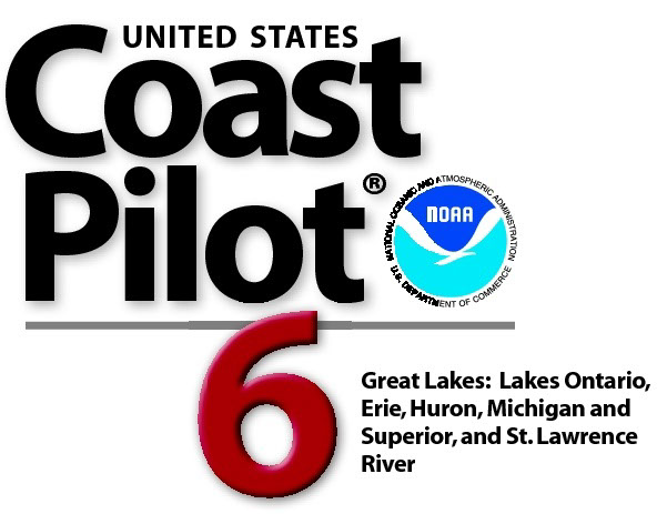
Coast Pilot 6 covers the Great Lakes system, including Lakes Ontario, Erie, Huron, Michigan, and Superior, their connecting waters, and the St. Lawrence River.
Edition 45. 2016.
This book now has a link to an interactive app.
The app links to charts, aerial photos, marinas, port authorities, wind charts, anchorages, tides, weather, local knowledge, tips, boatbuzz forum, itineraries, nav rules, ocean currents, safety information, traffic services, radio frequencies, videos, docks, fuel, supplies, lighthouses, repairs, marine parks, general knowledge, sightseeing, environmental issues, warnings, Federal Regulations, Wikipedia, Facebook forum, U.S.C.G. and more.
+ Your screen can become a full screen weather radar.
+ See the surrounding ships in real time on your screen with a link to AIS.
+ View updated charts using online chart viewer.
+ Before departure download and print current charts in booklet form.
Coast Pilot 6 covers the Great Lakes system, including Lakes Ontario, Erie, Huron, Michigan, and Superior, their connecting waters, and the St. Lawrence River.
Topics in the Coast Pilot include channel descriptions, anchorages, bridge and cable clearances, currents, tide and water levels, prominent features, pilotage, towage, weather, ice conditions, wharf descriptions, dangers, routes, traffic separation schemes, small-craft facilities, and Federal regulations applicable to navigation.
CH 1. GENERAL INFORMATION
This is a huge resource on the app with hundreds of useful links to Government, USCG, Wikipedia etc.
CH 2. NAVIGATION REGULATIONS.
This chapter contains extracts from Code of Federal Regulations (CFR) that are of importance to mariners in the area covered by this Coast Pilot.
CH 3. The Great Lakes
The Great Lakes system includes Lakes Ontario, Erie, Huron, Michigan, and Superior, their connecting waters, and the St. Lawrence River. It is one of the largest concentrations of fresh water on the earth. The system, including the St. Lawrence River above Iroquois Dam, has a total shoreline of about 11,000 statute miles (9,559 nm), a total water surface area of about 95,000 square statute miles (24,600,000 hectares), and a total drainage basin of almost 300,000 square statute miles (77,700,000 hectares). With the opening of the St. Lawrence Seaway, the system provides access by oceangoing deep-draft vessels to the heartland of the North American continent. From the Strait of Belle Isle at the mouth of the Gulf of St. Lawrence, the distance via the St. Lawrence River to Duluth, MN, at the head of Lake Superior is about 2,340 statute miles (2,033 nm) and to Chicago, IL, near the south end of Lake Michigan is about 2,250 statute miles (1,955 nm). About 1,000 statute miles (870 nm) of each of these distances is below Montreal, the head of deep-draft ocean navigation on the St. Lawrence River.
CH 4. St. Lawrence River Above St. Regis
The St. Lawrence River 744 statute miles (672.6 nm) long, is one of the principal rivers of North America and provides access for oceangoing vessels to the Great Lakes and heartland of the continent. The river flows northeast from its head in Lake Ontario, first along the United States-Canadian border, thence through the south part of Quebec Province past the cities of Montreal and Quebec before emptying into the Gulf of St. Lawrence. In its upper part, the river is wide and is filled with the Thousand Islands. Below Cornwall, ON, the river widens into Lake St. Francis, thence into Lake St. Louis, thence descends through Lachine Rapids to Montreal. Lake St. Peter, another widened section, is between Sorel and Trois Rivieres. Below the city of Quebec, the river is a tidal estuary which gradually increases to a width of 90 statute miles (78.2 nm) at the mouth.
CH 5. Lake Ontario
Lake Ontario is the smallest and easternmost of the Great Lakes. The lake is comparatively deep; the greatest depth is 802 feet, and the average depth is 283 feet, much in excess of the greatest depth of Lake Erie. Lake Ontario is fed chiefly by the waters of Lake Erie by way of the Niagara River. The lake drains at its northeast end into the St. Lawrence River. Welland Canal bypasses the falls and rapids of the Niagara River and provides a navigable connection between Lake Ontario and the upper lakes.
CH 6. Lake Erie
Lake Erie is the southeasternmost and fourth largest of the five Great Lakes. With a greatest depth of 210 feet, it is the shallowest of the lakes and the only one with a floor above sea level. The deepest part of the lake is generally at the east end, while the island region in the west part of the lake is the most shallow. The lake has an average depth of 62 feet. The lake is fed at the northwest end by water from Lake Huron via St. Clair River, Lake St. Clair, and Detroit River. The only natural outlet of the lake is at the northeast end through Niagara River. Welland Canal bypasses the falls and rapids of Niagara River and provides a navigable connection to Lake Ontario.
CH 7. Detroit River
Detroit River is about 32 miles long from Detroit River Light at its mouth in Lake Erie to Windmill Point Light at the head of the river at Lake St. Clair.
The lower part of the river is broad and is filled by many islands and shallow expanses. The river banks in this part are more flatly sloping than those in the upper river. The river bottom is generally earth and boulders, except for a section of bedrock and boulders about 6 miles north of the lower end of Bois Blanc Island. Extensive rock excavation and dredging have been necessary to provide channels for deep-draft vessels.
CH 8. Lake St. Clair
Lake St. Clair is an expansive shallow basin, with low, marshy shores and a flatly sloping bottom. The lake has a greatest natural depth of 19 feet. St. Clair River flows from north and enters the north part of the lake through several channels of a wide delta area. The outflow of the lake is at the southwest end through the Detroit River. The chief importance of the lake is the dredged deep-draft channel that leads across it to connect Detroit River and St. Clair River. No large commercial facilities or harbors are on the lake.
CH 9. St. Clair River
St. Clair River is about 39 miles long from Lake St. Clair via St. Clair Cutoff Channel and South Channel to the head of the river at Lake Huron. The lower 11 miles of the river is a broad delta through which numerous channels flow into Lake St. Clair. St. Clair Cutoff Channel and South Channel form the main navigation route through the delta and connect with the dredged channel across Lake St. Clair. The upper river, above Chenal Ecarte, is generally a single deep channel, except where obstructed by Fawn Island and Stag Island. The banks of the river are clay and sand and usually quite steep.
CH 10. Lake Huron
Lake Huron is the second largest of the Great Lakes. Three large bays extend from the main body of the lake, Saginaw Bay on the west side and North Channel and Georgian Bay on the northeast side. The lake receives the waters of Lake Michigan through the Straits of Mackinac and those of Lake Superior from the St. Marys River. The lake discharges at its south end into St. Clair River at Fort Gratiot. The lake is a connecting link in the Great Lakes chain. The depth of water in St. Marys River, St. Clair River, and Detroit River governs the draft of vessels navigating Lake Huron to and from Lakes Superior and Erie.
CH 11. Lake Michigan
Lake Michigan is the third largest of the Great Lakes and is the only one entirely within the United States. The only natural outlet of the lake is at the north end through the Straits of Mackinac. At the south end of the lake, the Illinois Waterway provides a connection to the Mississippi River and the Gulf of Mexico. The north part of the lake has many islands and is indented by several bays; Green Bay and Grand Traverse Bay are the largest. The shores in the south part of the lake are regular, and it has been necessary to construct artificial harbors. The forested shores in the north part of the lake are sparsely populated, while those in the south part are near the heart of the great urban industrial area of the U.S. Midwest.
CH 12. St. Marys River
St. Marys River forms the outlet of Lake Superior, connecting it with Lake Huron. From Whitefish Bay at the southeast corner of Lake Superior, the river flows in a general southeast direction to empty into Lake Huron at Point De Tour, a distance of 63 to 75 miles depending on the route traveled. The river is bounded on the west side for its entire length by the east end of the upper peninsula of Michigan and on the east side by the Ontario mainland in the upper part and Drummond Island, MI and St. Joseph Island, ON in the lower part
CH 13. Lake Superior
Lake Superior the largest freshwater lake in the world, is the northernmost, westernmost, highest, and deepest of the five Great Lakes. The lake is fed by the waters of many short swift-flowing streams and drains through the St. Marys River into Lake Huron. The shores of the lake are generally high, rocky, and forested. The lake is sparsely populated, especially along the north shore.
CH 14. Hudson River, New York Canals, and Lake Champlain
The Hudson River extends north from The Battery at New York City for about 152 miles to the head of tidal navigation at the Troy Lock and Dam at Troy, NY. (This section of the Hudson River is described in United States Coast Pilot 2, Cape Cod to Sandy Hook.)
A Federal project provides for a 32-foot channel from New York City to Albany, thence a 14-foot channel to the Troy Lock and Dam.
APPENDIX A
SALES INFORMATION
APPENDIX B
METEOROLOGICAL DATA
U.S. COAST PILOT 7
Coast Pilot 7 covers the rugged United States coast of California, Oregon and Washington, between Mexico on the south and Canada's British Columbia on the north. Coast Pilot 7 also includes Hawaii and other United States territories in the South Pacific.
Edition 48 for 2016.
The app links to charts, aerial photos, marinas, port authorities, wind charts, anchorages, tides, weather, local knowledge, tips, boatbuzz forum, itineraries, nav rules, ocean currents, safety information, traffic services, radio frequencies, videos, docks, fuel, supplies, lighthouses, repairs, marine parks, general knowledge, sightseeing, environmental issues, warnings, Federal Regulations, Wikipedia, Facebook forum, U.S.C.G. and more. + Your screen can become a full screen weather radar. + See the surrounding ships in real time on your screen with a link to AIS. + View updated charts using online chart viewer. + Before departure download and print current charts in booklet form.
Coast Pilot 7 covers the rugged United States coast of California, Oregon and Washington, between Mexico on the south and Canadas British Columbia on the north. Coast Pilot 7 also includes Hawaii and other United States territories in the South Pacific.
The United States Coast Pilot® consists of a series of nautical books that cover a variety of information important to navigators of coastal and intracoastal waters and the Great Lakes. Issued in nine volumes, they contain supplemental information that is difficult to portray on a nautical chart.
Topics in the Coast Pilot include channel descriptions, anchorages, bridge and cable clearances, currents, tide and water levels, prominent features, pilotage, towage, weather, ice conditions, wharf descriptions, dangers, routes, traffic separation schemes, small-craft facilities, and Federal regulations applicable to navigation.
Chapter 1. GENERAL INFORMATION.
The app links to hundreds of pieces of useful information.
Chapter 2. NAVIGATION REGULATIONS
The complete online updated Code of Federal Regulations is linked in the app.
Chapter 3. California, Oregon, and Washington
The California-Oregon-Washington coast of the United States, between Mexico on the S and Canada’s British Columbia on the N, is mostly rugged and mountainous, with high land rising abruptly from the sea in many places. S of San Francisco Bay the mountains are usually bare or covered with chaparral and underbrush. N of the bay the mountains are generally well timbered, and in some places, especially N of the Columbia River, the timber is particularly dense and heavy.
Chapter 4. San Diego to Point Arguello, California
This chapter describes the 240-mile irregular coast of southern California from the Mexican border to Point Arguello. The coast extends in a general NW direction and includes the major ports of San Diego, Long Beach, Los Angeles, and Port Hueneme. This chapter also describes the recreational and fishing ports of Oceanside, Newport Beach, Ventura, Santa Barbara, and the many other ports on San Pedro and Santa Monica Bays and along the Santa Barbara Channel.
Chapter 5. CHANNEL ISLANDS.
This chapter describes the eight Channel Islands that extend for 130 miles in a NW direction off the coast of southern California from San Diego to Point Conception. They include the four islands of the southern group–San Clemente, Santa Catalina, San Nicolas, and Santa Barbara; and the four islands of the northern group also referred to as the Santa Barbara Islands–Anacapa, Santa Cruz, Santa Rosa, and San Miguel. Also described are the passages and channels between these islands including Outer Santa Barbara Passage, San Pedro Channel, Anacapa Passage, Santa Cruz Channel, San Miguel Passage, and Santa Barbara Passage, and Avalon Bay, the most active harbor in the area, as well as many smaller harbors and landings
Chapter 6. Point Arguello to San Francisco Bay, California
This chapter describes the waters of San Luis Obispo, Estero, Morro, Monterey, and Half Moon Bays; also, the port of Port San Luis, and the small-craft and commercial fishing harbors of Morro Bay, Monterey, Moss Landing, Santa Cruz, and Pillar Point. The coast, except for the bays, is rugged with many detached rocks close inshore and other dangers extending no more than 2 miles offshore.
Chapter 7. San Francisco Bay, California. Chart 18640
(2) San Francisco Bay the largest harbor on the Pacific coast of the United States, is more properly described as a series of connecting bays and harbors of which San Francisco Bay proper, San Pablo Bay, and Suisun Bay are the largest. Depths of 29 to 40 feet are available for deep-draft vessels to San Francisco, Oakland, Alameda, Richmond, and Redwood City in San Francisco Bay proper; to Stockton on the San Joaquin River; and to Sacramento through the lower Sacramento River and a deepwater channel.
Chapter 8. San Francisco Bay to Point St. George, California. Chart 18010
This chapter describes Bodega Bay, Tomales Bay, Noyo River and Anchorage, Shelter Cove, Humboldt Bay, and numerous other small coves and bays. The only deep-draft harbor is Humboldt Bay, which has the largest city along this section of the coast, Eureka. The other important places, all for small craft, are Bodega Harbor, Noyo River, Shelter Cove, and Crescent City Harbor. The coast is rugged and often mountainous, with many detached rocks. The principal dangers, all marked, are Blunts Reef, Redding Rock, and St. George Reef.
Chapter 9. Chetco River to Columbia River, Oregon
This chapter describes 200 miles of the Oregon coast from the mouth of the Chetco River to the mouth of the Columbia River. Also described are the Chetco and Rogue Rivers, Port Orford, Coquille River, Coos Bay, Umpqua and Siuslaw Rivers, Yaquina Bay and River, Nehalem River, and Tillamook Bay. The cities of Coos Bay and North Bend on Coos Bay and Newport on Yaquina Bay are the only deep-draft ports on the Oregon coast. The principal dangers are unmarked Rogue River Reef, and Orford Reef, which is marked by a light.
Chapter 10. Columbia River, Oregon and Washington
This chapter describes the Columbia River from its mouth at the Pacific Ocean to the head of navigation above Richland, WA. Also described are its two major tributaries, the Willamette River in Oregon and the Snake River in Washington and Idaho. The deep-draft ports of Astoria, Longview, Portland, and Vancouver are described as well as many smaller ports.
Chapter 11. Columbia River to Strait of Juan De Fuca, Washington
This chapter describes the Pacific coast of the State of Washington from the Washington-Oregon border at the mouth of the Columbia River to the northwesternmost point at Cape Flattery. The deep-draft ports of South Bend and Raymond, in Willapa Bay, and the deep-draft ports of Hoquiam and Aberdeen, in Grays Harbor, are described. In addition, the fishing port of La Push is described. The most outlying dangers are Destruction Island and Umatilla Reef
Chapter 12. Strait of Juan De Fuca and Georgia, Washington. Chart 18400
(2) This chapter includes the Strait of Juan de Fuca, Sequim Bay, Port Discovery, the San Juan Islands and its various passages and straits, Deception Pass, Fidalgo Island, Skagit and Similk Bays, Swinomish Channel, Fidalgo, Padilla, and Bellingham Bays, Lummi Bay, Semiahmoo Bay and Drayton Harbor, and the Strait of Georgia as far N as Burrard Inlet. The more important U.S. harbors described are Neah Bay, Port Angeles, Friday Harbor, La Connor, Anacortes, Bellingham, and Blaine Harbor. Deep-draft vessels use the harbors at Port Angeles, Anacortes, and Bellingham, the principal cities in the area.
Chapter 13. Puget Sound, Washington
This chapter describes Puget Sound and its numerous inlets, bays, and passages, and the waters of Hood Canal, Lake Union, and Lake Washington. Also discussed are the ports of Seattle, Tacoma, Everett, and Olympia, as well as other smaller ports and landings.
Chapter 14. HAWAII
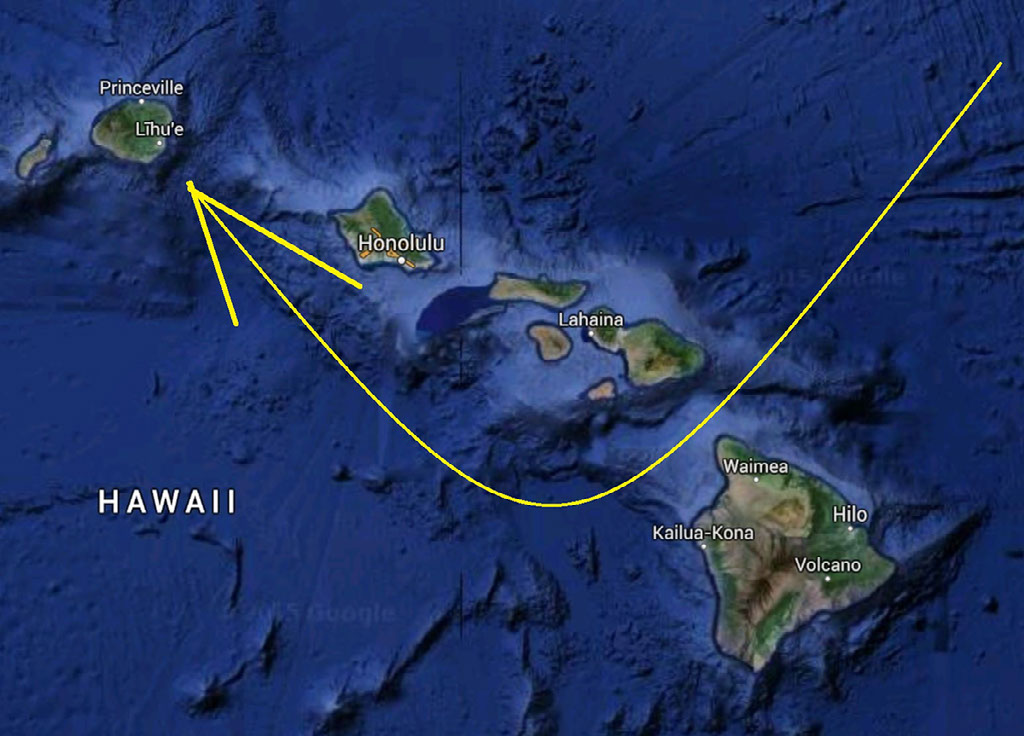
The Hawai‘ian Islands an archipelago, consist of eight large islands, plus many islets, reefs, and shoals, strung out from SE to NW for 1,400 nautical miles in the north-central Pacific Ocean. The archipelago extends from 18°55'N. to 28°25'N., and from 154°49'W. to 178°20'W., straddling the Tropic of Cancer. All the islands of the archipelago, except 2-square-mile Midway, are part of the State of Hawaii
Chapter 15. PACIFIC ISLANDS
Islands and Pacific waters discussed in this chapter are other than those of the Hawai‘ian Archipelago.
Appendix A. Sales Information
NOAA publications, nautical charts and unclassified National Geospatial-Intelligence Agency (NGA) nautical charts are sold by authorized sales agents in many U.S. ports and in some foreign ports
Appendix B. Meteorological Data
HAWAII
U.S. COAST PILOT 8
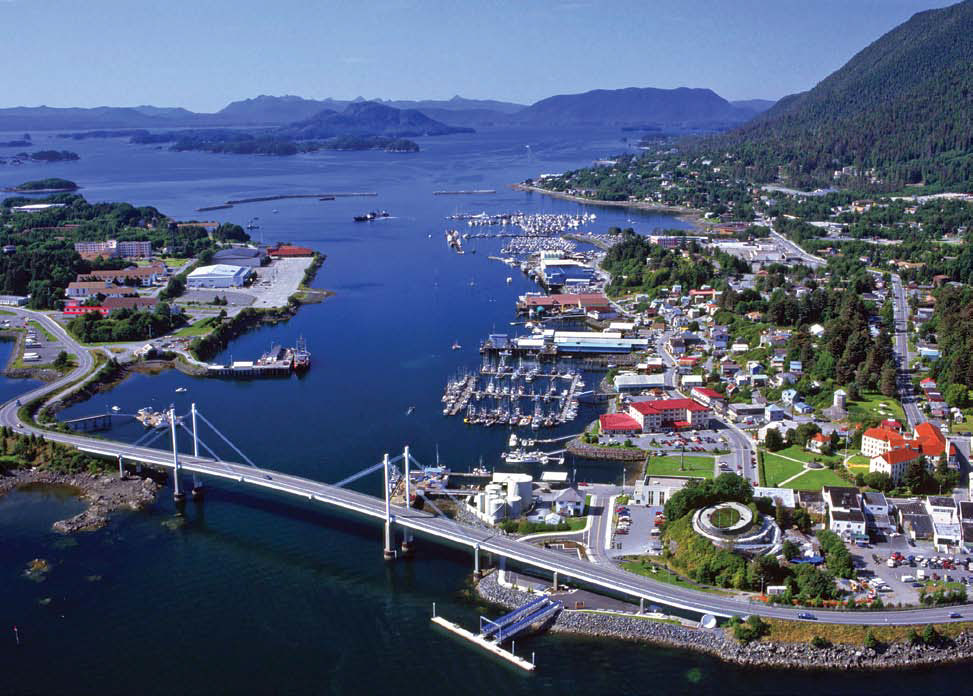
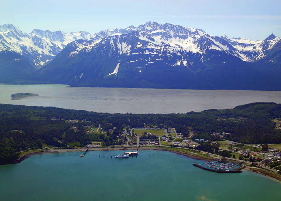
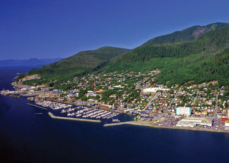
Coast Pilot 8 covers the panhandle section of Alaska between the south boundary and Cape Spencer. In this volume, general ocean coastline is only 250 nautical miles, but tidal shoreline totals 11,085 miles.
Edition 37. 2016.
This book now has a link to an interactive app.
The app links to charts, aerial photos, marinas, port authorities, wind charts, anchorages, tides, weather, local knowledge, tips, boatbuzz forum, itineraries, nav rules, ocean currents, safety information, traffic services, radio frequencies, videos, docks, fuel, supplies, lighthouses, repairs, marine parks, general knowledge, sightseeing, environmental issues, warnings, Federal Regulations, Wikipedia, Facebook forum, U.S.C.G. and more.
+ Your screen can become a full screen weather radar.
+ See the surrounding ships in real time on your screen with a link to AIS.
+ View updated charts using online chart viewer.
+ Before departure download and print current charts in booklet form.
Coast Pilot 8 covers the panhandle section of Alaska between the south boundary and Cape Spencer. In this volume, general ocean coastline is only 250 nautical miles, but tidal shoreline totals 11,085 miles
Topics in the Coast Pilot include channel descriptions, anchorages, bridge and cable clearances, currents, tide and water levels, prominent features, pilotage, towage, weather, ice conditions, wharf descriptions, dangers, routes, traffic separation schemes, small-craft facilities, and Federal regulations applicable to navigation.
CH 1. GENERAL INFORMATION
This is a huge resource on the app with hundreds of useful links to Government, USCG, Wikipedia etc.
CH 2. NAVIGATION REGULATIONS.
This chapter contains extracts from Code of Federal Regulations (CFR) that are of importance to mariners in the area covered by this Coast Pilot.
CH 3. Alaska-Dixon Entrance to Cape Spencer
Alaska the largest of the United States, occupies the northwestern part of the North American continent. The State is bordered on the E and S by Canada and on the W and N by the Pacific and Arctic Oceans. The northernmost point of Alaska is Point Barrow (71°23'N., 156°28'W.); the westernmost point is Cape Wrangell (52°55'N., 172°26'E.) on Attu Island; and the southernmost point is Nitrof Point (51°13.0'N., 179°07.7'W.), on Amatignak Island. Cape Muzon (54°40'N., 132°41'W.) is on the historic parallel which is the coastal boundary between Alaska and Canada’s British Columbia. Cape Muzon is on the N side of Dixon Entrance and is 480 miles NW of Cape Flattery, Washington; between the two United States capes is the coastal area of British Columbia.
CH 4. Dixon Entrance to Ketchikan
This chapter describes the waters of Dixon Entrance, Pearse and Portland Canals, Revillagigedo Channel, Tongass Narrows, Carroll and George Inlets, Behm Canal, Ward Cove, and the city and harbor of Ketchikan.
Dixon Entrance is exposed to the rigors of the nearby Pacific. Gales blow frequently from October through April, mainly out of the SE, up the Hecate Strait. Sometimes N gales draw down Portland Inlet across the NE end of Chatham Sound, making the crossing from Dundas Island to Cape Fox hazardous. Strong SW winds create a heavy beam sea on this same crossing. Swells approach Dixon Entrance mostly from the W and SW, particularly in winter. They move through passages, break on shoals or against shorelines, and are heavy at times. In Caamano Passage, the W coast of Dundas Island experiences almost continuous heavy swell. Parry Passage, as well as the W and N coasts of Langara Island, is subject to prevailing ocean swell.
CH 5. Clarence Strait, Dixon Entrance to Wrangell
This chapter describes Clarence Strait and the subsidiary channels to Sumner Strait and Wrangell. Also described are the numerous tributaries, islands, islets, towns, and villages related to these waterways. Preferred passages through these waterways are discussed.
Charts 17420, 17360
Clarence Strait extends in a N direction from Dixon Entrance for 45 miles to Guard Islands and the W entrance to Tongass Narrows and Behm Canal, and thence in a NW direction for 67 miles to Sumner Strait. From its S entrance to Zarembo Island, a distance of about 100 miles, the channel is broad and comparatively free from dangers. At Zarembo Island the strait divides. The channel E of the island, called Stikine Strait, is the route taken by vessels to Wrangell and Wrangell Narrows; that W of the island, called Snow Passage, is used by vessels bound to Wrangell Narrows or W through Sumner Strait because it is more direct.
CH 6. West Coast of Prince of Wales Island
This chapter covers the outer coast between Dixon Entrance and Sumner Strait, and includes the inlets and bays on the W coast of Prince of Wales Island, and the off-lying islands with the connecting bodies of water. The area is described in the following order: Forrester Island and W coast of Dall Island; Meares Passage; Cordova Bay; Hetta Inlet; Sukkwan Strait; Kaigani Strait; Tlevak Strait and Narrows; Ulloa Channel; Bucareli Bay, San Alberto Bay, and Klawock Inlet; Port Real Marina, Portillo Channel, and San Christoval Channel; Arriaga Passage, Gulf of Esquibel, and Tonowek Bay; Bocas de Finas; Tonowek Narrows; Tuxekan Passage, Davidson Inlet, Sea Otter Sound, and El Capitan Passage. The cities of Hydaburg on Sukkwan Narrows, and Craig and Klawock on Klawock Inlet are described in this chapter.
CH 7. Sumner Strait
This chapter describes Iphigenia Bay, Sumner Strait, and the many bays bordering it, the S part of Keku Strait including Rocky Pass, Duncan Canal, Wrangell Narrows, Dry Strait, Stikine River, and the city and harbor of Petersburg.
Charts 17360, 17400
Sumner Strait is one of the great inlets into southeastern Alaska from the sea. The strait has three entrances. The main entrance from the sea, between Coronation Island and Warren Island, is about 5.8 miles wide. Warren Channel, the entrance E of Warren Island, between it and Cape Pole, is about 1.2 miles wide and is used by vessels bound to and from Davidson Inlet and Bucareli Bay. Decision Passage, the entrance between Cape Decision and the Spanish Islands, is about 1 mile wide and is used by vessels bound to and from Chatham Strait. These entrances are described under separate headings.
CH 8. Frederick Sound
This chapter describes Frederick Sound, Le Conte and Thomas Bays, the N part of Keku Strait, Saginaw and Security Bays, and the city and harbor of Kake.
Charts 17320, 17360
Frederick Sound has its entrance from Chatham Strait between Kingsmill Point and Point Gardner and extends NE to The Brothers and Cape Fanshaw, at the entrance to Stephens Passage, and SE to Dry Strait, a high-water boat passage connecting it with the E end of Sumner Strait. The sound is open and clear of obstructions, and has few offshore dangers to navigation. The shores and islands of the sound are all high.
CH 9. Stephens Passage
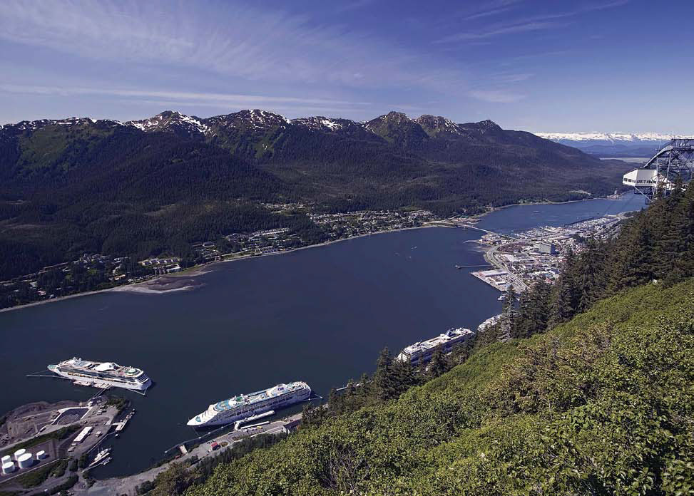
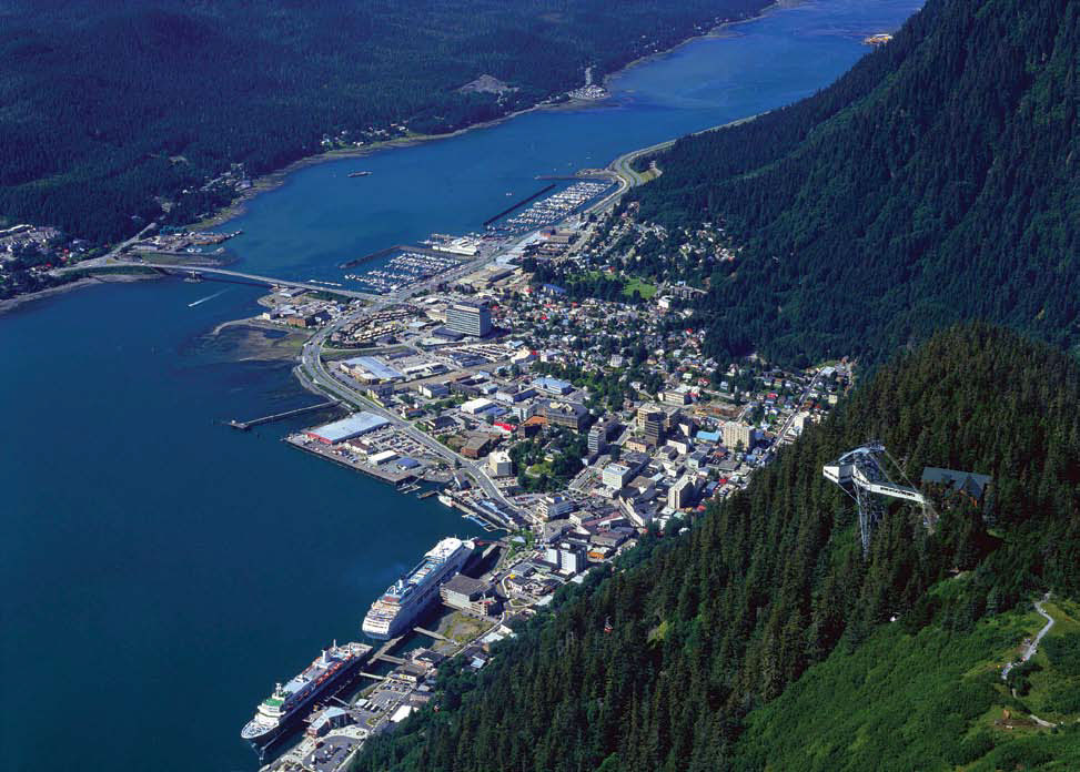
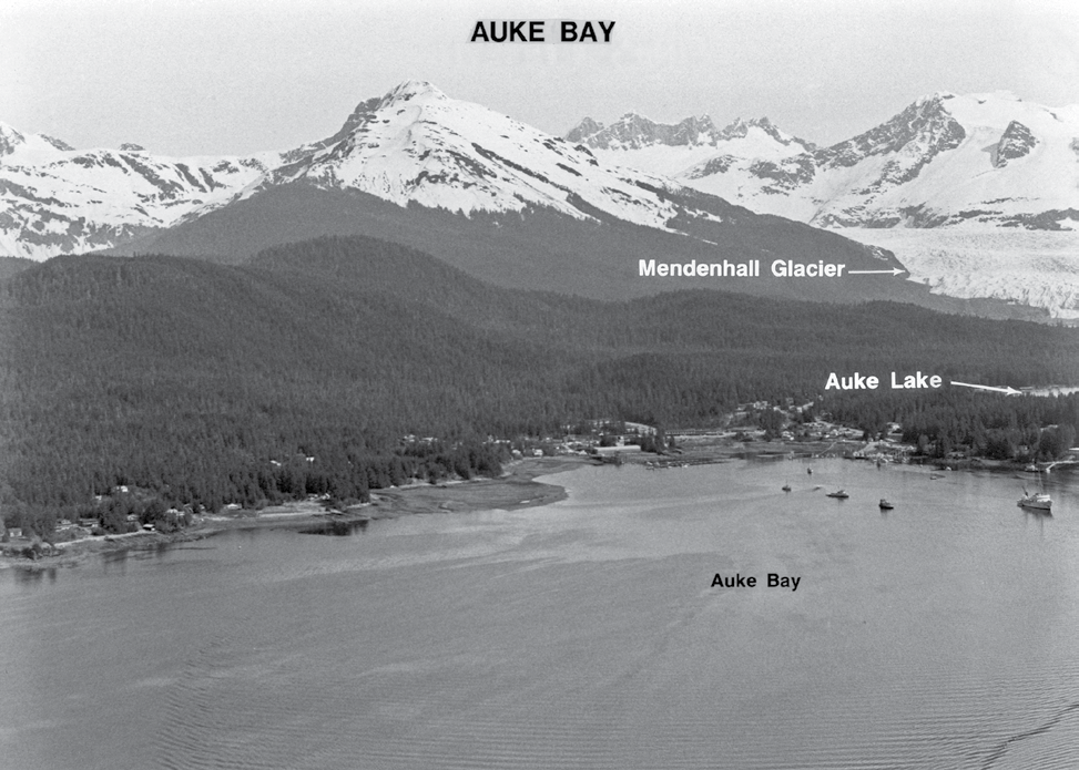
This chapter describes Stephens Passage, Holkham Bay, Endicott Arm, Tracy Arm, Taku Harbor, Gastineau Channel, Auke Bay, Tee Harbor, and the city of Juneau, including the communities of Douglas and Auke Bay.
Chart 16016
Stephens Passage extends from its junction with Frederick Sound at Cape Fanshaw (57°11.1'N., 133°34.3'W.) in a general NNW direction for about 88 miles to Shelter Island, which divides it into two channels, Saginaw Channel and Favorite Channel, and connects it with Lynn Canal. Numerous islands are in both entrances to the passage, but otherwise it is open, deep, and generally free from dangers.
CH 10. Chatham Strait
This chapter describes Chatham Strait and its tributaries. Also described are the settlements of Baranof, Angoon, Tenakee Springs, and Port Alexander, including the various logging camps in the bays, inlets, and coves along the strait.
Chart 16016
Chatham Strait is the most extensive of the inland passages of southeastern Alaska. It is about 18 miles wide at its entrance between Cape Ommaney and Coronation Island and about 13.5 miles between the cape and the W shore of Kuiu Island, with a length of 138 miles from Coronation Island N to Rocky Island. The main strait is clear, open, and deep throughout, but some of the bays and bights are foul. In the winter, ice forms in many of the bays and inlets, particularly those into which large freshwater streams empty and which have narrow entrances. The W shore as far as Point Augusta is high, bluff, and rugged, and free from hidden dangers in the way of navigation from point to point, except in the vicinity of the E entrance to Peril Strait. The water is shoaler on the E side, and the reefs extend out farther, but in most cases they are in the bights and bays, and in no case do they extend beyond a line drawn 0.5 mile off from point to point, except a ledge about 1 mile offshore at Point Crowley.
CH 11. Lynn Canal
This chapter describes the waters of Lynn Canal, and Chilkat, Chilkoot, Lutak, and Taiya Inlets. Also discussed are the port facilities at Port Chilkoot, Haines, Skagway, and in Lutak Inlet.
Chart 17300
Lynn Canal extends from the junction of Chatham Strait and Icy Strait, at Hanus Reef, in a NNW direction for about 58 miles to Seduction Point, where it divides into two arms, called Chilkat Inlet and Chilkoot Inlet; the latter inlet extends 25 miles farther N from Seduction Point. At Rocky Island, the canal is 5 miles wide; from Point Howard to Ralston Island about 3 miles wide; thence it averages 6 miles wide to Seduction Point. The canal is nearly free of dangers, and the water is generally very deep. The shores as a rule are very high and wooded, with many bare mountain peaks and small glaciers in nearly every ravine. It is reported that in the winter N winds in the canal often attain a maximum speed of about 70 knots.
CH 12. West Coast of Baranof Island
This chapter describes the W coast of Baranof Island, the coasts of Kruzof Island and Sitka Sound, and the city and port of Sitka. The E coast of Baranof Island has been described with Chatham Strait in chapter 10.
Chart 17320
Baranof Island about 90 miles long with a greatest width of about 22 miles, forms about one-third of the outer coastline of southeastern Alaska between Cape Muzon and Cape Spencer. The W coast from Cape Ommaney at Chatham Strait to Point Kakul at Peril Strait is about 80 miles. Mt. Katlian 4,303 feet high, is in the N part of the island. The greater elevations are on the S part of the island.
CH 13. Salisbury Sound and Peril Strait
This chapter describes Salisbury Sound, Hoonah Sound and Peril Strait, the inside passage from Chatham Strait to Sitka, via Neva Strait and Olga Strait.
Chart 17320
Weekly scheduled mail and passenger vessels bound from Wrangell, Petersburg, Juneau, or Skagway to Sitka pass through Peril Strait and Salisbury Sound and then proceed S through Neva Strait and Olga Strait. Under adverse conditions, when coming S from Juneau or Skagway, they sometimes pass through Icy Strait and Cross Sound, then outside to Salisbury Sound before entering Neva Strait. Sergius Narrows in Peril Strait is a difficult passage to make under any conditions, because of its narrowness and strong tidal currents and eddies. Passage through Sergius Narrows should only be attempted at slack water and preferably at high-water slack, and with local knowledge. Small craft, barge, and ship traffic is heavy through the narrows; caution is advised.
CH 14. West Coast of Chichagof Island and Yakobi Island
This chapter describes the W coast of Chichagof Island and Yakobi Island from Fortuna Strait to Cape Bingham. Also discussed are the numerous bays and coves, and an inside passage for small vessels that extends along the greater part of this coast.
The W coast of Chichagof Island has a general NW direction for about 38 miles from the W end of Klokachef Island to Cape Cross, and then the coast trends N for 10 miles to Yakobi Rock. The main shore is formed by Chichagof Island which has numerous mountain peaks. From Klokachef Island to Khaz Bay the 100-fathom curve is about 13 miles offshore. The 50-fathom curve is about 6 miles offshore, and inside of that distance the soundings are irregular and less than 50 fathoms, except a narrow pocket with depths of 50 to 101 fathoms, which extends about 5.5 miles SW from Khaz Bay entrance. From the entrance of Khaz Bay to Cape Edward, the coast is formed by numerous islets, rocks, and breakers, that prevent a close approach to the shore.
CH 15. Cross Sound and Icy Strait
This chapter describes Cross Sound and Icy Strait, which are the northernmost sea connections for the inland passages of southeastern Alaska. Also described are the tributary waterways and the various communities in the area, such as Pelican, Elfin Cove, Gustavus, and Hoonah.
Chart 17300
Cross Sound and Icy Strait are the northernmost sea connections for the inland passages of southeastern Alaska, separating the mainland between Cape Spencer and Point Couverden, and from Yakobi Island and Chichagof Island between Cape Bingham and Point Augusta. The waterway is about 61 miles long from Cape Spencer at the W entrance to Point Augusta, at its junction with Chatham Strait. It averages 4 to 8 miles wide, but in places this is reduced by islands.
APPENDIX A
SALES INFORMATION
APPENDIX B
METEOROLOGICAL DATA
U.S. COAST PILOT 9
Coast Pilot 9 deals with the Pacific and Arctic coasts of Alaska from Cape Spencer to the Beaufort Sea. General ocean coastline totals 5,520 nautical miles, and tidal shoreline totals 18,377 miles.
Edition 33. 2016.
This book now has a link to an interactive app.
The app links to charts, aerial photos, marinas, port authorities, wind charts, anchorages, tides, weather, local knowledge, tips, boatbuzz forum, itineraries, nav rules, ocean currents, safety information, traffic services, radio frequencies, videos, docks, fuel, supplies, lighthouses, repairs, marine parks, general knowledge, sightseeing, environmental issues, warnings, Federal Regulations, Wikipedia, Facebook forum, U.S.C.G. and more.
+ Your screen can become a full screen weather radar.
+ See the surrounding ships in real time on your screen with a link to AIS.
+ View updated charts using online chart viewer.
+ Before departure download and print current charts in booklet form.
Coast Pilot 9 deals with the Pacific and Arctic coasts of Alaska from Cape Spencer to the Beaufort Sea. General ocean coastline totals 5,520 nautical miles, and tidal shoreline totals 18,377 miles
Topics in the Coast Pilot include channel descriptions, anchorages, bridge and cable clearances, currents, tide and water levels, prominent features, pilotage, towage, weather, ice conditions, wharf descriptions, dangers, routes, traffic separation schemes, small-craft facilities, and Federal regulations applicable to navigation.
CH 1. GENERAL INFORMATION
This is a huge resource on the app with hundreds of useful links to Government, USCG, Wikipedia etc.
CH 2. NAVIGATION REGULATIONS.
This chapter contains extracts from Code of Federal Regulations (CFR) that are of importance to mariners in the area covered by this Coast Pilot.
CH 3. Cape Spencer to Beaufort Sea
Alaska the largest of the United States, occupies the NW part of the North American continent. The State is bordered on the E and S by Canada and on the W and N by the Pacific and Arctic Oceans. The northernmost point of Alaska is Point Barrow (71°23'N., 156°28'W.); the westernmost point is Cape Wrangell (52°55'N., 172°26'E.) on Attu Island; and the southernmost point is Nitrof Point (51°13.0'N., 179°07.7'W.), on Amatignak Island. Cape Muzon (54°40'N., 132°41'W.) is on the historic parallel which is the coastal boundary between Alaska and Canada’s British Columbia. Cape Muzon is on the N side of Dixon Entrance and is 480 miles NW of Cape Flattery, Washington; between the two United States capes is the coastal area of British Columbia.
CH 4. Cape Spencer to Cook Inlet
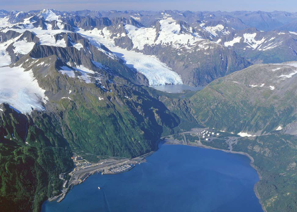
This chapter describes the S coast of the Alaska mainland from Cape Spencer to Cook Inlet, and the many passages and tributary waters of Prince William Sound and Cook Inlet. Also described are the deepwater ports of Valdez, Whittier, Anchorage, and Seward, and the petroleum terminals and facilities on the Kenai Peninsula, as well as the numerous fishing and logging ports in this area.
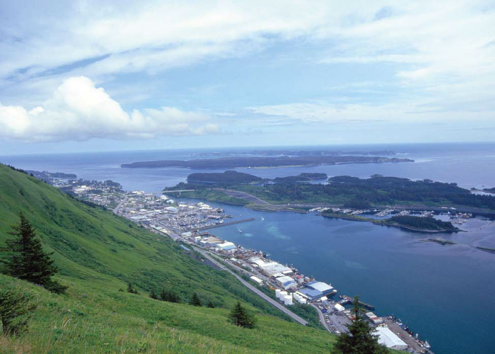
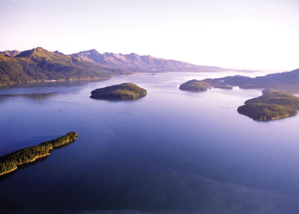
CH 5. Kodiak Island
This chapter describes Afognak and Kodiak Islands and the numerous smaller off-lying islands which surround their shores. Also described are the various passes and straits leading between these islands, the port of Kodiak, and the numerous other fishing villages
CH 6. Alaska Peninsula
This chapter describes the S coast of the Alaska Peninsula from Cape Douglas to Isanotski Strait, as well as the Semidi Islands, Shumagin Islands, Sanak Islands, and many other smaller off-lying islands that fringe this part of the coast. Also described are Katmai Bay, Wide Bay, Chignik Bay, Stepovak Bay, Unga Strait, Pavlof Bay, Ikatan Bay, Isanotski Strait, and many smaller bays and lagoons, and the fishing communities of Sand Point, King Cove, Cold Bay, and False Pass.
CH 7. Aleutian Islands
This chapter describes the Aleutian Islands and the many passes leading from the Pacific Ocean into the Bering Sea. Also described are the harbors of Dutch Harbor on Unalaska Island, Kuluk Bay on Adak Island, Massacre Bay on Attu Island, and many other smaller harbors in the Aleutian Islands.
CH 8. Bering Sea
This chapter describes the N coast of the Alaska Peninsula, the W coast of Alaska including Bristol Bay, Norton Sound, and the numerous bays indenting these areas. Also described are the Pribilof Islands, and Nunivak, St. Matthew, and St. Lawrence Islands. The communities of Nome, Unalakleet, Bethel, King Salmon, Naknek, Port Moller, and St. George are also discussed
CH 9. Arctic Ocean
This chapter describes the Arctic Ocean coastline of Alaska from the Bering Strait to Demarcation Point, at the boundary between the United States and Canada, and the waters of Kotzebue Sound and Prudhoe Bay. Also discussed are the Diomede Islands, Barter Island, and many of the off-lying coastal islands, and the more important towns and communities in this area including Wales, Kotzebue, Wainwright, and Barrow.
APPENDIX A
SALES INFORMATION
APPENDIX B
METEOROLOGICAL DATA
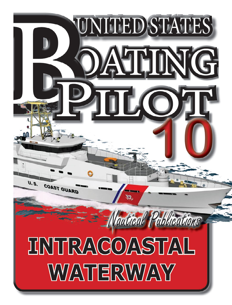
INTRACOASTAL WATERWAY
INTRACOASTAL WATERWAY
2016.
This book now has a link to an interactive app.
The app links to charts, aerial photos, marinas, port authorities, wind charts, anchorages, tides, weather, local knowledge, tips, boatbuzz forum, itineraries, nav rules, ocean currents, safety information, traffic services, radio frequencies, videos, docks, fuel, supplies, lighthouses, repairs, marine parks, general knowledge, sightseeing, environmental issues, warnings, Federal Regulations, Wikipedia, Facebook forum, U.S.C.G. and more.
+ Your screen can become a full screen weather radar.
+ See the surrounding ships in real time on your screen with a link to AIS.
+ View updated charts using online chart viewer.
+ Before departure download and print current charts in booklet form.
Coast Pilot intracoastal waterway.
Topics in the Coast Pilot include channel descriptions, anchorages, bridge and cable clearances, currents, tide and water levels, prominent features, pilotage, towage, weather, ice conditions, wharf descriptions, dangers, routes, traffic separation schemes, small-craft facilities, and Federal regulations applicable to navigation.
CH 1. GENERAL INFORMATION
This is a huge resource on the app with hundreds of useful links to Government, USCG, Wikipedia etc.
CH 2. NAVIGATION REGULATIONS.
This chapter contains extracts from Code of Federal Regulations (CFR) that are of importance to mariners in the area covered by this Coast Pilot.
CH 3. CP3 – 5
Intracoastal Waterway
(1) The Intracoastal Waterway is a toll-free passage which roughly parallels the Atlantic Coast and extends 118 statute miles through bays, lagoons, thorofares, and land cuts from Manasquan Inlet to Delaware Bay at a point 2 miles north of Cape May Light.
(2) In addition to the Intracoastal Waterway and the waters through which it passes, this chapter also describes the several rivers and tributaries that empty into these waters, as well as some of the more important towns and landings along these waterways.
(3) The Intracoastal Waterway is used mainly by pleasure craft, and commercial and sport fishing vessels. The U. S. Army Corps of Engineers, Philadelphia Engineer District, has supervision of the waterway’s construction, maintenance, and operation. (See Appendix A for address.)
(4) Mileage
(5) The Intracoastal Waterway mileage is zeroed in 40°06'03"N., 74°01'55"W., off the outer ends of the Manasquan Inlet jetties, which are 40 nautical miles by outside run from The Battery, N.Y.
(6) Distances along the Intracoastal Waterway are in statute miles to facilitate reference to the small-craft charts 12324, 12316; all other distances are nautical miles.
CH 4. P4 – 12
CP4-12
Intracoastal Waterway
(1) The part of the Intracoastal Waterway described here is the toll-free “canal” which affords continuous protected passage behind the Atlantic Coast and the Florida Keys for more than 1,243 statute miles between Norfolk, VA, and Key West, FL Route 1 the basic route, follows Albemarle and Chesapeake Canal to Albemarle Sound; Route 2 the alternate route, is through Great Dismal Swamp Canal to the sound.
(2) Also described in this chapter is the Okeechobee Waterway, which junctions with the Intracoastal Waterway in St. Lucie Inlet.
(3) The Intracoastal Waterway is used by commercial light-draft vessels and tows unable to navigate long stretches in the open ocean, and by pleasure craft. Small-boat and recreation facilities are found along the waterway. Supervision of the waterway’s construction, maintenance, and operation is divided among five U.S. Army Corps of Engineers (USACE) Districts (Norfolk, Wilmington, Charleston, Savannah, and Jacksonville)
CH 5. CP5 -12
CP5-12
Intracoastal Waterway
(1) This chapter describes the Intracoastal Waterway a toll-free “canal” from Caloosahatchee River, FL, to Brownsville, TX. The waterway except for a 140-mile stretch, Anclote River to Carrabelle, FL, is a protected route inside the W coast of Florida and behind the Gulf Coast. The waterway is discussed in two sections: Caloosahatchee River to Anclote River, a distance of 150 statute miles; and Carrabelle to Brownsville, a distance of 1,059 statute miles. The outside route is described in chapter 5.
(2) Also discussed in this chapter are the alternate routes of the Intracoastal Waterway: Algiers Alternate Route; Landside Route; Morgan City-Port Allen Alternate Route; and Atchafalaya River Route.
(3) Supervision of the Intracoastal Waterway’s construction, maintenance, and operation is divided among four U.S. Army Engineer Districts: Jacksonville, Mobile, New Orleans, and Galveston.
(4) Mileage
(5) The first section of the waterway is zeroed in 26°30.6'N., 82°01.1'W., near the mouth of the Caloosahatchee River at its junction with Okeechobee Waterway.
(6) Distances along the Intracoastal Waterway are in statute miles to facilitate reference to the small-craft charts; all other distances are in nautical miles.
APPENDIX A
SALES INFORMATION
APPENDIX B
METEOROLOGICAL DATA