Great Ocean Road December 2015
Something that has been on my bucket list for awhile now is doing another run down the Great Ocean Road, with a decent camera. So now with the camera and SUV we decided just before Christmas would be a great time, nice and quiet – and mostly it was.
So what is the G.O.R? The Great Ocean Road is an Australian National Heritage listed 243 kilometres (151 miles) stretch of road along the south-eastern coast of Australia between the Victorian cities of Torquay and Allansford. Built by returned soldiers between 1919 and 1932 and dedicated to soldiers killed during World War I, the road is the world’s largest war memorial. Winding through varying terrain along the coast and providing access to several prominent landmarks, including the Twelve Apostles, London Bridge, Whale watching, and many other attractions. The areas also travelled included the Surf Coast, the Discovery (Or ship wreck) Coast and the Limestone Coast. You can also walk it……..there is a trail the whole way – no thank you!
Airy’s Inlet
We drove around town a bit and then headed for the Split Point Lighthouse; my first of many Lighthouses/Light Stations on this trip. We stopped for coffee at the converted old Stables, now a cafe (really bad coffee). We walked along the bluff and then walked out to the beach, caves, rocks, birds, surf and a shot of the light house from below……….we spent many hours exploring this area.
Lorne
Finally we dragged ourselves away and continued along until Lorne. There are a lot of waterfalls at Lorne, but after stopping and briefly and speaking to locals, there is no water. Everything is so dry, the creek beds, and rivers are almost dry in some areas, so waterfalls a waste of time in Summer……..this is a spring spot, apart from the beach, of course. Great beaches. Also a little known gem called Teddy’s Lookout, a little hard to find but so worth it. Lorne is officially the start of the Great Ocean Road.
We briefly stopped at Carissbrook Creek, where there is a creek meandering down to the ocean and hundreds, and hundreds of cairns, or stacked stones. It was difficult to get to with blackberry bushes everywhere. There were small cairns, big ones, some as tall as Roy!
Apollo Bay
Eventually we left and made our way to Apollo Bay, stayed at the Sand Piper Motel and ate at the Sandy Feet, great steak and Gluten Free meals. Briefly wandered around town as sun set (but we were on the wrong side of the hills to photograph it).
Cape Otway
We set our alarms for early; 3:45am to give us plenty of time to drive to Cape Otway Light Station for sunrise. Which I was assured I could shoot. After the early start and long drive out there it was shut, locked up tight behind huge metal gates……….could not even see it from the car park. We walked up to the look out and only barely see the top of it. To add insult to injury it was a brilliant sunrise, which we could barely see from the car park, due to the trees! The park did not open until 10am………so we left in disgust, not wanting to waste 5 hours until it opened. I wander HOW they get all the sunrise or even sunset shots when the park closes at 5pm?
We briefly stopped of at Maits Rest Rainforest, but it was still very early (Sun just peaking through the trees); quite dark, but we never saw any animals?
Moonlight Head
We then continued on to the official start for ship wrecks. We headed out to the secluded Moonlight Head and Gable Cove (Wreck Beach)for some relics. It is a rough 4WD track and quite rugged in some spots, but easily passable at this time of year. These are the only relics we saw in any of the locations we visited, some items in museums etc, but nothing still on the beach. Be warned there are 440 odd extremely steep steps to get to Wreck Beach, I stayed behind (due to my knee), shots on the beach were taken by Roy! The anchor and windlass are from the Marie Gabrielle.
Port Campbell
We then continued onto and entered the Port Campbell National Park; visited Gibson’s Steps and out first look at the 12 Apostles. Another gruelling set of steps, beach shots by Moth again.
Among many scenic and famous spots we visited was; Twelve Apostles, Razorback, Loch Ard Gorge, Thunder Cave, Castle Cove, Mutton Bird Island, and various other spots of interest.
We headed over to Port Campbell to arrange out accommodation, get dinner and then we headed back out to Twelve Apostles to shoot the sunset……….we were not disappointed!
The Arch is the latest version of the Bridge, still attached to the main land. London Bridge broke away from the mainland in 1990, some say the Arch is better, but I still prefer the London Bridge. While Roy climbed up and down countless stairs I stayed at the looked out and took some much needed long exposures. They are a form of meditation! We stopped in next at The Grotto. I have never heard of this one before, must be fairly new.
Peterborough
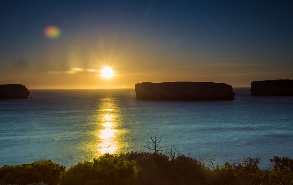
We then proceeded onto the Bay of Martyrs, which is absolutely stunning and another wreck The Falls of the Halladale (almost impossible to find!). We found the plaque and anchor near a playground in Peterborough, by chance.
Back through Peterborough for the Bay of Islands. We went through quite a few little known tracks (after chatting to a few locals the night before) and found the perfect spot for sunset. Finding no decent, cheap accommodation in Peterborough we went back to Port Campbell for a hotel and dinner.
After dinner we headed back out to the Boat Bay for sunset, not quiet as good as the night before, sadly. We then drove the long, dark drive back to the hotel, dodging kangaroos and wallabies all the way.
Childers Cove
Left Port Campbell and again drove back through Peterborough, in search of a few more ship wrecks, this time at Childers Cove. If you find Radford’s Road and drive right to the end there is a secluded little spot where the John Scott and the Antares were lost. Everyone on the John Scott was saved, but all hands were lost on the Antares. The Antares was the last major shipping disaster in the area, although many others have perished in smaller vessels or rock fishing. Further down the road is another secluded little cove called Childers Beach, again more stairs to a pretty little beach. This was the sight of yet another wreck Children (where on earth do they come up with these names?). All along this stretch were so many beautiful beaches and NO Tourists, it was a lovely pleasant morning. Eventually we headed off to Warrnambool
Warrnambool
First stop was Logan’s Beach Whale Sanctuary, whale watching beach………..mostly Southern Right Whales in Winter (May – October), not summer so no whales for me, just lots of beach and surfers.
We then headed over to the Flagstaff Hill Maritime Village, this is a replica Maritime village, and lots of fun, although very hot and no shade.
Had a lovely lunch in the Pippies Restaurant and then wandered around Lady Bay Harbour (More ship wreck sites – 10 in fact) and then the Breakwater, Thunder Point, gave up looking for Shelley Beach.
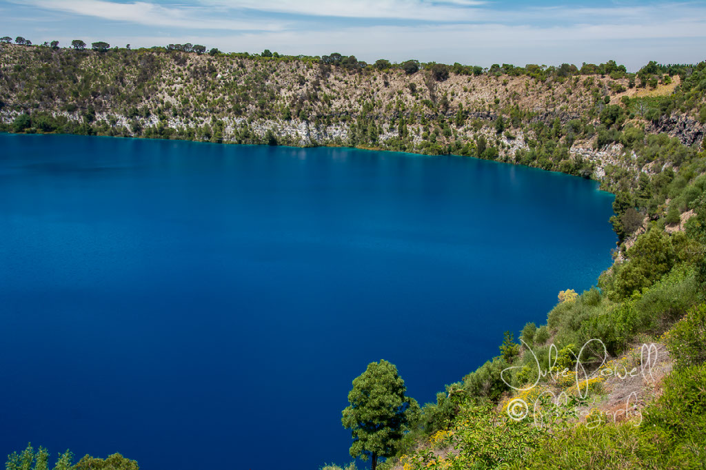
After a busy few days, we decided on a little sleep in. We then headed over to Tower Hill, by the time we got there it was already getting very hot. The weather for the last few days had been wonderful, but now we knew it was Summer. Instead of the long walk to the top, we made the shorter (more sheltered) walk along the Lava Board Walk. Apart from a few brush birds (finch and such) we only saw a few curious emus. Tower Hill is an ancient volcanic crater, now a wildlife reserve.
Port Fairy
Finally we made our way over to Port Fairy. In the distance we saw what we at first thought was smoke, growing larger as we got nearer to Port Fairy, however we could not smell smoke and the radio said bush fires in Portland, so we assumed it was from that. When we arrived in Port Fairy…….it was like something out of a horror movie, The Fog! Technically it’s called sea mist. It was still very warm and quite humid, but allowed little visibility.
We stopped by Artillery Hill to see the guns and defences, then drove around the Port and Breakwater. Eventually we drove to the little walk bridge that leads to Griffith Island (and another Light House). The Sea Mist by this stage was getting worse. Made for some eerie, dramatic light house shots!We walked the 1.25 kms to the Lighthouse, saw a little black faced wallaby and explored the island as much as we could see.
We continued our drive onto Portland, hoping for better weather, we saw many desolate and abandoned buildings, burnt out, decayed with age and neglect. It is kind of sad, but beautiful in their own right, and quite frankly a photographers dream.
Portland
Sea mist had dissipated only marginally, we drove around town for a bit, then headed out to Cape Nelson for another lighthouse, some 4WD tracks and wind farms. We gave up on any of the look outs, could not see a thing, but we did find another wallaby.
Cape Nelson
Heading back into town we went to Whaler’s Bluff, with the skies clearing. Looks like a great sport to shoot sunrise, IF the weather holds clear. There are 100’s of ship wrecks in and around this port, most of which cannot be seen from land, many have never been found, some are for divers only. We had hoped to visit the Tram Depot, Seals by Sea, Artillery after shooting sunrise in the morning. But by now getting late, time for dinner and a hotel for the night.
Picked the worst hotel in Portland it seemed, woke in agony. But at least we didn’t spend too much time there, as we planned a sunrise shoot back at Whaler’s Bluff. It was not very cold, but cloudy and we had hoped it might dissipate, but by the time sunrise hit, the sea mist was back with a vengeance and we could see nothing. All thoughts of a return trip to Cape Nelson lighthouse, the wind farms and a few others items became apparent; just were not worth the time. We wandered around town, stop by a few old churches, the town hall and artillery hill, then headed to Cape Bridgewater. We even spotted a peacock just ambling along the side of the road?
Cape Bridgewater
Due to the now ever present Sea Mist, Cape Bridgewater was almost a lost cause, no seals by sea cruise, nor whale watching for me. We drove out to the Petrified Forest (Not a real forest), and the Blow Hole where one can usually see whales at this time of year – no show for us.
This is actually past the end of the official Great Ocean Road, but as we were still going on our trip, so will the images!
We drove out to Nelson (on the S.A. border) and decided that inland might be the way to go. Spoke to the Information lady who suggested we try Mt Gambier and possibly the Sink Hole Gardens and then Tantaloola Caves; as they are easier to negotiate than the Rose Caverns at Nelson. The further we headed inland the hotter it became, but at least the sea mist eventually disappeared.
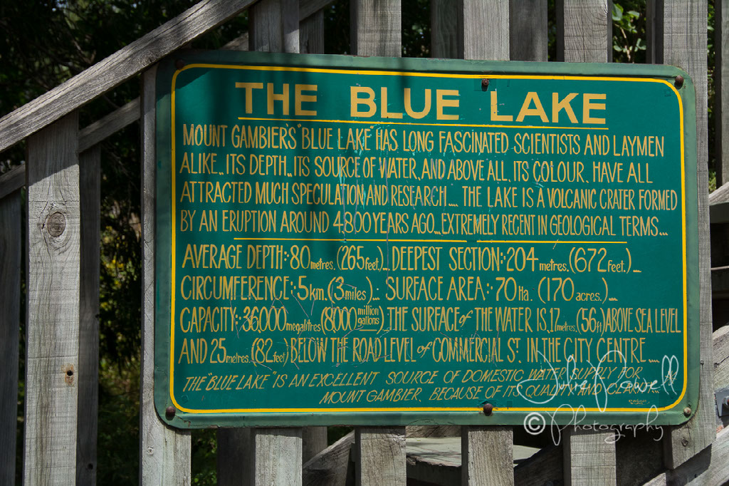
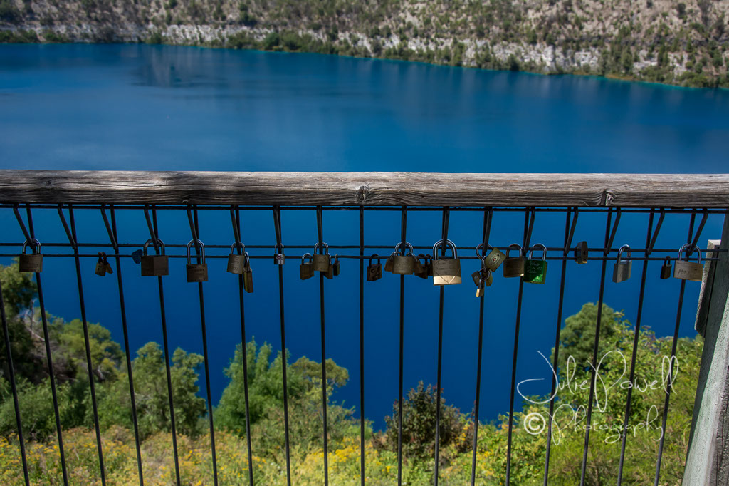
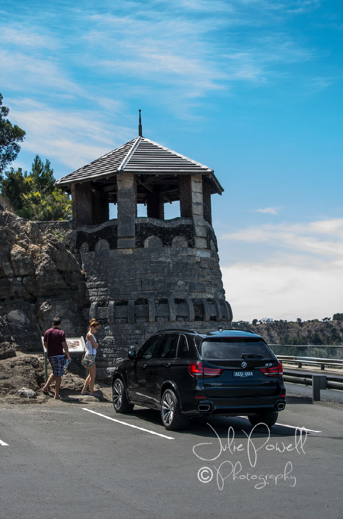
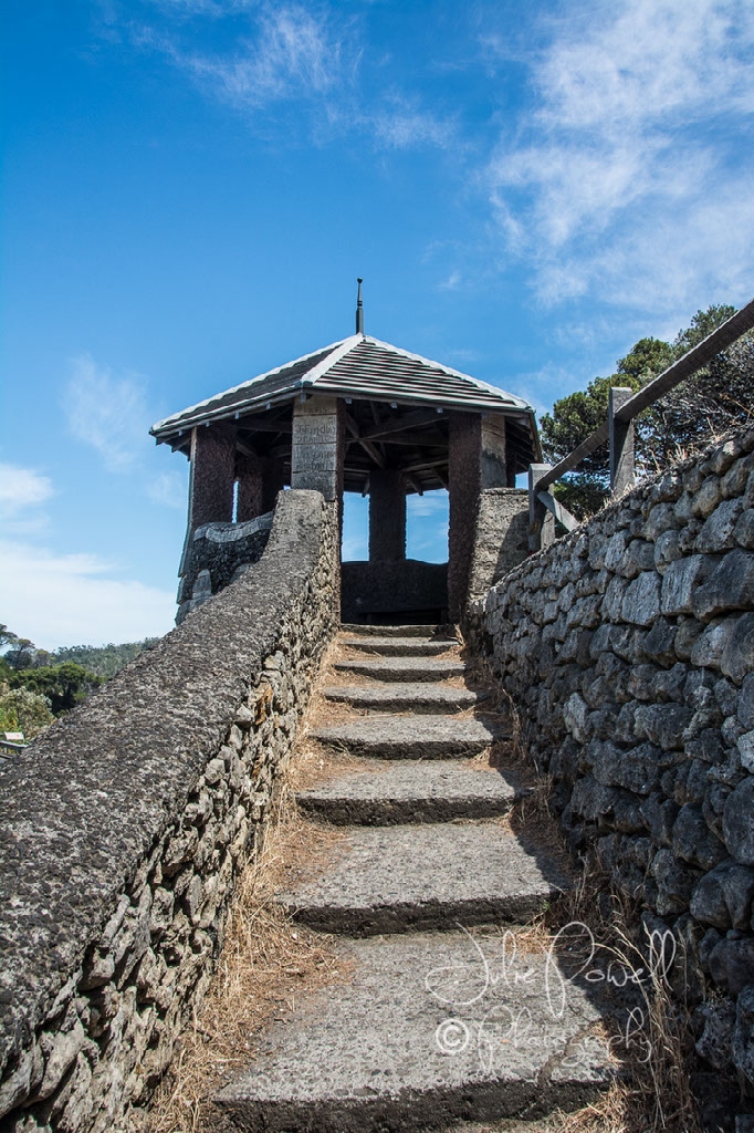
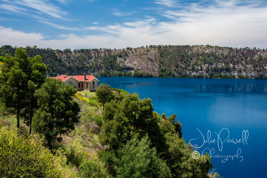
We visited 3 of the major sink holes in Mt Gambier, including the Garden Caves (right in town), the Umpherston Sinkhole, and the Engelbrecht Caves. I stayed at the top and shot pretty flowers and chased bees! I was happy.
Tantanoola
We then drove on to Tantanoola and visited the caves, where we got a rare treat. Due to it being so very quiet we were allowed in there with cameras AND tripods, for as long as we wanted! Amazing. Limited flash photography (wouldn’t have worked anyway) and don’t touch anything (oils from your skin can damage the stalactites), they were our only rules.
We stopped in at the Lady Nelson Museum and Information Centre, and found lots of interesting places on the way to Hamilton via Casterton. We wanted to stay at Casterton, fascinating old historic town, maybe next trip? Then spent the night in Hamilton. It was so dry everywhere we just knew something had to go by the end of the bush fire season, it was actually kind of scary driving through in the 40C + plus temperatures.
Penhurst via Hamilton
We left Hamilton early, the weather was becoming hotter. We made a few detours and headed to Penshurst via Tarrington, stopped and took photos of some great Hay Bale Art, apparently this is a yearly thing for the residents, it was a lot of fun; albeit very hot (My favourite is Yoda!). It had hit over 40C by 10am and it was climbing, with dry gusty winds.
We drove to the lookout at Mount Rouse in Penshurst and walked along the shady track over looking the Grampian ranges. There were hundreds of butterflies everywhere, sadly none of my shots worked :-( There is also steep steps (129) to the lookout; Roy went, I took the track around. We then drove through Horsham, Camperdown, Anglesea, The Stony Rises, finally onto Geelong. We stopped at many interesting and some derelict buildings for photos as we went, but we did not stop anywhere for too long, as it was so hot (hit 45C). We eventually drove home from here.